Stake attention in this memory
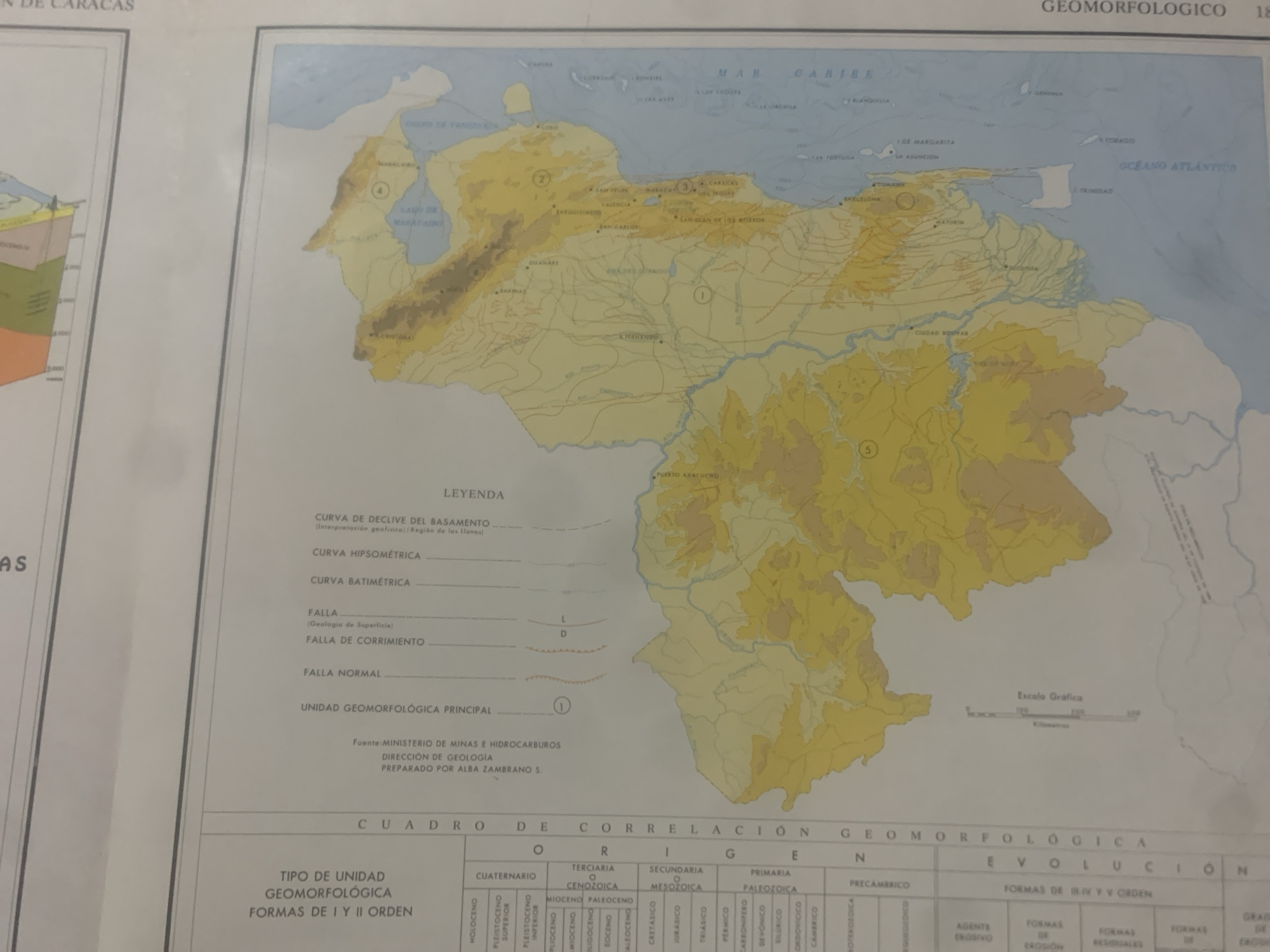
This is a photograph of a map displayed on a wall. The map depicts the geomorphological regions of Venezuela. The primary subject is the map itself, which is detailed and colorful, showing elevation contours, water bodies like the Caribbean Sea and Atlantic Ocean, and various geographical features. Cities and towns are marked with dots and labels. The map appears to be part of an educational or informational display, possibly in a museum or research institution. No people are directly visible in the photograph, but the presence of a wall and the way the map is mounted suggests an indoor setting. The lighting is artificial and even, indicating the photo was taken indoors during the day. Notable details include the "LEYENDA" (Legend) which explains different map symbols, such as curves of declive, hipsometric and bathymetric curves, and fault lines. There is also a "CUADRO DE CORRELACIÓN GEOMORFOLÓGICA EVOLUCIÓN" (Geomorphological Correlation Table Evolution) at the bottom, detailing geological periods. A graphic scale bar is present, indicating distances in kilometers. Visible text includes "GEOMORFOLÓGICO", "MAR CARIBE", "OCEANO ATLANTICO", city names like "CARACAS", "VALENCIA", "MARACAIBO", and geographical terms such as "LAGO DE MARACAIBO", "ISLA DE MARGARITA". The source of the map is attributed to the "MINISTERIO DE MINAS E HIDROCARBUROS". The overall context suggests an academic or scientific presentation of Venezuelan geography.
Symbol
51F4C
Volume
0
Creator
+$0.14
Revenue
+$0.00
TVL
$0.00
2
Rev Bot 🤖💰
Injected revenue 6d ago
“Revenue bonus for the last stake.”
+$0.25 USD


