
Sign in
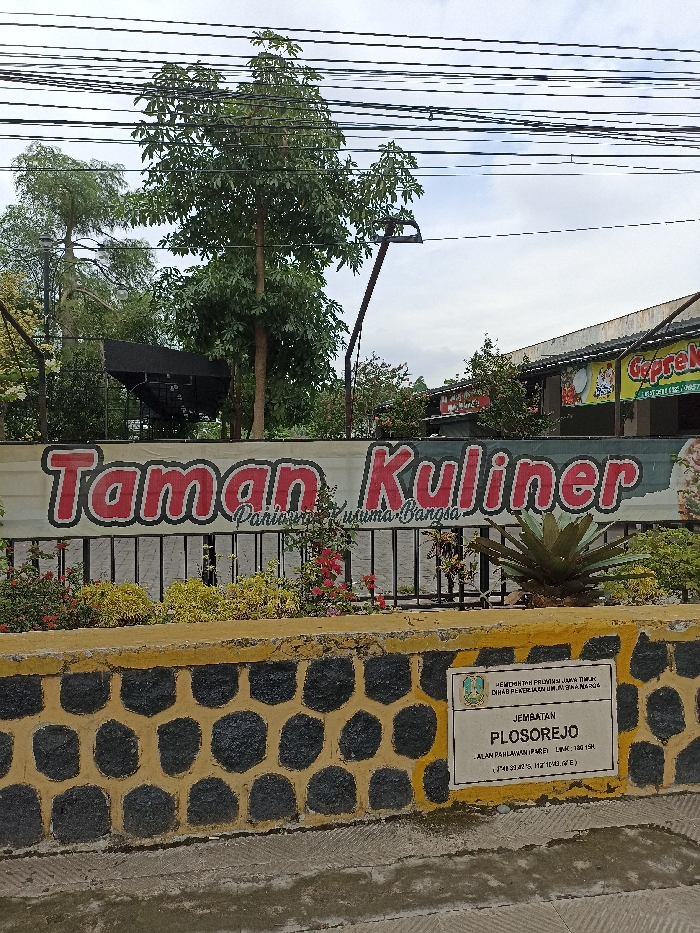
An outdoor daylight shot captures the entrance to a culinary area, likely in Kecamatan Pare, Indonesia, under an overcast sky. The foreground features a low stone wall with a distinctive yellow and black octagonal pattern. Attached to the right side of this wall is a white plaque.

Dominating the mid-ground is a large banner displaying "Taman Kuliner" in prominent red lettering with a white outline. Below this, smaller text reads "Panjiwa Kusuma Bangsa." Behind the banner, an iron fence is visible, along with various green trees and shrubs, some adorned with small red flowers. A large, leafy tree stands prominently on the left side, extending into the upper frame.

In the background, to the right, parts of buildings are visible, including one with a sign for "Geprek" and numbers "1957" and "0857" below it, indicating a specific restaurant. Numerous black power lines crisscross the upper portion of the image against the cloudy, light grey sky. An agave-like plant sits atop the stone wall on the right.

The plaque on the wall provides specific location details:
- "PEMERINTAH PROVINSI JAWA TIMUR" (Government of East Java Province)
- "DINAS PEKERJAAN UMUM BINA MARGA" (Department of Public Works and Highways)
- "JEMBATAN PLOSOREJO" (Plosorejo Bridge)
- "JALAN PAHLAWAN PARE LINK: 130.150" (Pahlawan Street Pare Link: 130.150)
- Geographical coordinates are also present: (7°41'39.42"S, 112°10'43.00"E).
FM-DWNFF3

Dec 15, 2024, 6:19 AM

Kecamatan Pare, Indonesia

Stake attention in this memory

An outdoor daylight shot captures the entrance to a culinary area, likely in Kecamatan Pare, Indonesia, under an overcast sky. The foreground features a low stone wall with a distinctive yellow and black octagonal pattern. Attached to the right side of this wall is a white plaque. Dominating the mid-ground is a large banner displaying "Taman Kuliner" in prominent red lettering with a white outline. Below this, smaller text reads "Panjiwa Kusuma Bangsa." Behind the banner, an iron fence is visible, along with various green trees and shrubs, some adorned with small red flowers. A large, leafy tree stands prominently on the left side, extending into the upper frame. In the background, to the right, parts of buildings are visible, including one with a sign for "Geprek" and numbers "1957" and "0857" below it, indicating a specific restaurant. Numerous black power lines crisscross the upper portion of the image against the cloudy, light grey sky. An agave-like plant sits atop the stone wall on the right. The plaque on the wall provides specific location details: - "PEMERINTAH PROVINSI JAWA TIMUR" (Government of East Java Province) - "DINAS PEKERJAAN UMUM BINA MARGA" (Department of Public Works and Highways) - "JEMBATAN PLOSOREJO" (Plosorejo Bridge) - "JALAN PAHLAWAN PARE LINK: 130.150" (Pahlawan Street Pare Link: 130.150) - Geographical coordinates are also present: (7°41'39.42"S, 112°10'43.00"E).

Loading AttnAds…

transactions
revenues
stakers
Earliest
Latest
Highest stake

No transactions found

More from this user

More from Kecamatan Pare

FM-DWNFF3

Dec 15, 2024, 6:19 AM

Kecamatan Pare, Indonesia

Licensed under Creative Commons Attribution 4.0 International License. You are free to share and adapt this content with proper attribution.