Stake attention in this memory
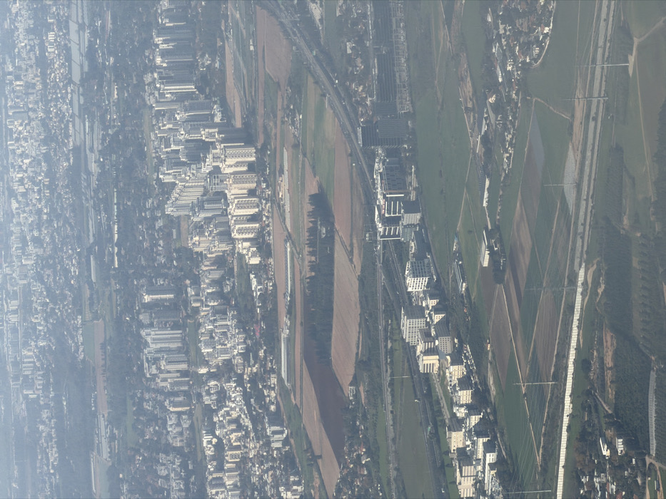
This aerial image depicts a segment of Petah Tikva, Israel, under conditions of atmospheric haze. The scene encompasses a diverse urban and rural landscape, viewed from an elevated, oblique perspective. In the upper portion of the frame, a densely populated urban area extends into the distant haze. This area is characterized by numerous light-colored, multi-story residential apartment buildings, many appearing as high-rises, clustered together with minimal discernible green spaces. The midground features a prominent multi-lane highway, possibly Highway 40, traversing diagonally from the upper right towards the lower-left. Multiple vehicles are present on the highway, but are too distant for specific identification. Adjacent to the highway, primarily on its western side, a modern commercial and industrial zone is visible. This zone contains several multi-story office and commercial buildings, typically of contemporary design with light-colored facades and dark windows, forming a business park (likely Kiryat Matalon or Kiryat Arye). Interspersed throughout the mid and lower portions of the image are significant tracts of agricultural land, displaying variations in color from tilled brown soil to green fields. A distinct cluster of dark green trees forms a small grove or forest patch within these fields. A linear white barrier or wall runs horizontally across the lower-mid section of the image, bordered by what appears to be a service road or path. Multiple tall power transmission towers with associated lines are visible, extending across the agricultural fields. The foreground contains further agricultural plots and some low-rise residential structures at the extreme bottom-left. No individuals are discernible anywhere in the image. The overall illumination suggests daylight.
No transactions found
More from this user