Stake attention in this memory
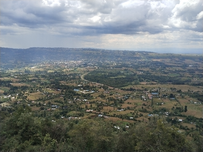
This elevated panoramic image displays the Waseges ward in Kenya under an overcast sky featuring gray cloud formations. The terrain presents as undulating, characterized by hills and valleys. In the immediate foreground, dense green tree canopy and shrubbery are visible. The midground and background reveal a sprawling rural-urban landscape. Numerous scattered buildings, predominantly light-colored, are dispersed across the area, indicating widespread human habitation. A distinct, denser concentration of structures, consistent with an urban center, is present in the central midground. A dark, curvilinear paved road, identified as a highway, traverses the midground, extending into the more densely built-up area. The land use includes cultivated fields, appearing as green and brownish-green patches, interspersed with natural vegetation. No individuals or specific actions are discernible within the captured scene.
No transactions found