
Sign in
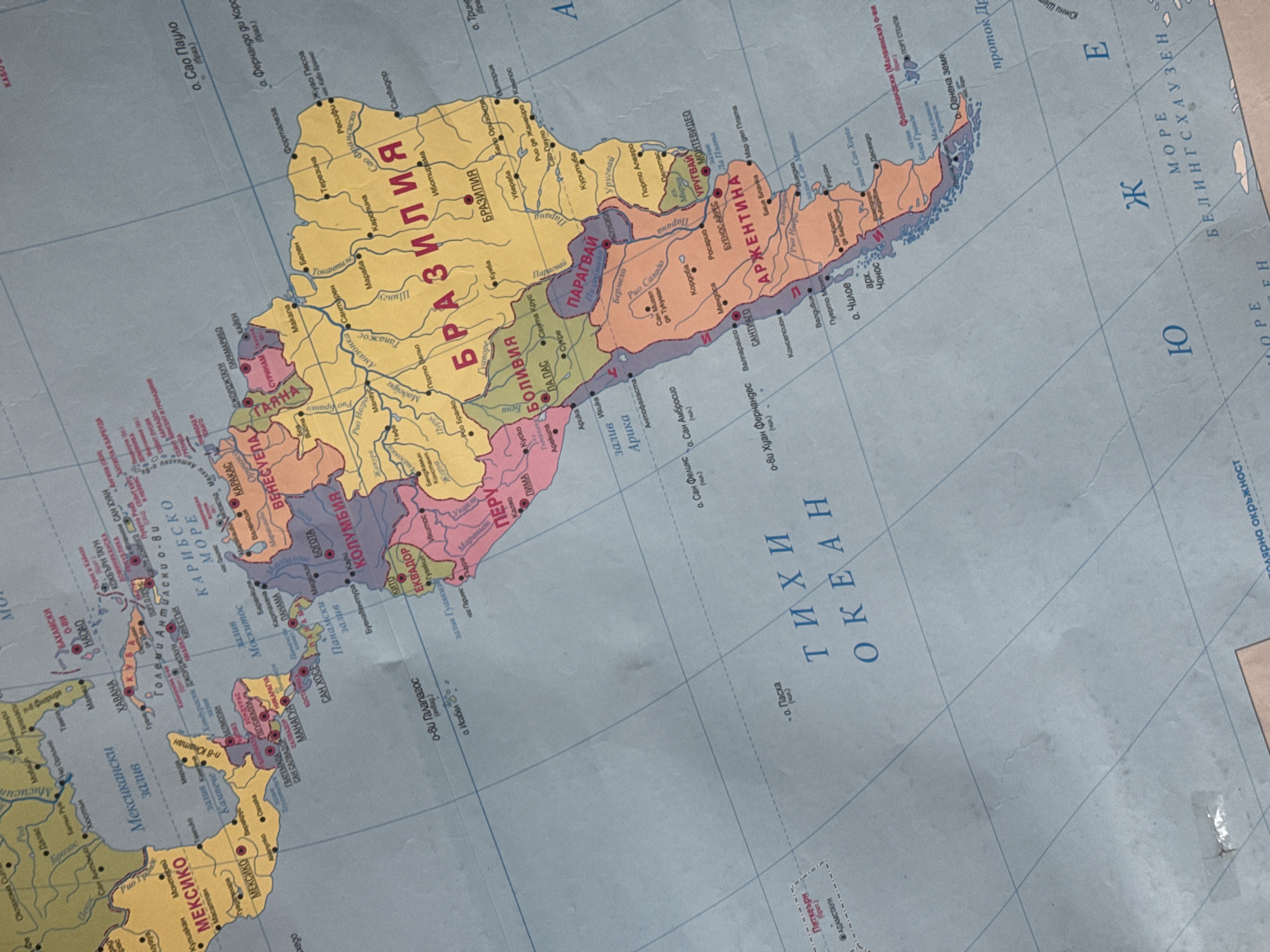
This is a close-up photograph of a section of a world map, specifically focusing on South America and parts of the Caribbean and Antarctic regions. The map is oriented with north generally towards the top left. The dominant colors are blues for the oceans and various pastel shades for landmasses, outlined in black.

The image displays numerous place names, country borders, and geographical features such as oceans, seas, gulfs, and peninsulas. Prominent labels in Cyrillic script indicate countries like "БРАЗИЛИЯ" (Brazil), "АРЖЕНТИНА" (Argentina), "ПЕРУ" (Peru), "БОЛИВИЯ" (Bolivia), "КОЛУМБИЯ" (Colombia), and "МЕКСИКО" (Mexico). Oceans are labeled as "ТИХИ ОКЕАН" (Pacific Ocean) and "КАРИБСКО МОРЕ" (Caribbean Sea). There are also labels for specific bodies of water and regions, such as the "Мексикански залив" (Gulf of Mexico) and "о. Огнена земя" (Tierra del Fuego). Islands are also marked, including "о-ви Галапагос" (Galapagos Islands) and "о-ви Хуан Фернандес" (Juan Fernández Islands).

The map appears to be a physical map, showing some elevation or topographical detail through shading on the landmasses. The surface of the map shows some creases and slight damage, including a small tear with white tape applied, suggesting it is an older or well-used map. The lighting suggests an indoor setting, likely with ambient light. No people are visible in the image. The focus is entirely on the cartographic details.
Victor Totev

Jun 18, 2026, 5:13 AM

Stara Zagora, Bulgaria

Moment

Stake attention in this memory

curiosity
wonder
exploration
adventure
nostalgia

This is a close-up photograph of a section of a world map, specifically focusing on South America and parts of the Caribbean and Antarctic regions. The map is oriented with north generally towards the top left. The dominant colors are blues for the oceans and various pastel shades for landmasses, outlined in black. The image displays numerous place names, country borders, and geographical features such as oceans, seas, gulfs, and peninsulas. Prominent labels in Cyrillic script indicate countries like "БРАЗИЛИЯ" (Brazil), "АРЖЕНТИНА" (Argentina), "ПЕРУ" (Peru), "БОЛИВИЯ" (Bolivia), "КОЛУМБИЯ" (Colombia), and "МЕКСИКО" (Mexico). Oceans are labeled as "ТИХИ ОКЕАН" (Pacific Ocean) and "КАРИБСКО МОРЕ" (Caribbean Sea). There are also labels for specific bodies of water and regions, such as the "Мексикански залив" (Gulf of Mexico) and "о. Огнена земя" (Tierra del Fuego). Islands are also marked, including "о-ви Галапагос" (Galapagos Islands) and "о-ви Хуан Фернандес" (Juan Fernández Islands). The map appears to be a physical map, showing some elevation or topographical detail through shading on the landmasses. The surface of the map shows some creases and slight damage, including a small tear with white tape applied, suggesting it is an older or well-used map. The lighting suggests an indoor setting, likely with ambient light. No people are visible in the image. The focus is entirely on the cartographic details.

Symbol

53F15

Volume

0

Creator

+$0.03

Revenue

+$0.00

TVL

$0.00

1D
1W
1M
All

Loading AttnAds…

transactions
revenues
stakers
Earliest
Latest
Highest stake

1

Wahid_Rahman_Afghanmal

Staked 24d ago
Redeemed 20d ago

$2.84 USD

+$0.02 USD

Fee: $0.01 (0.25%)

+0.5%

2

Rev Bot 🤖💰

Injected revenue 24d ago

Revenue bonus for the last stake.

+$0.06 USD

More from this user

More from Stara Zagora

Victor Totev

Jun 18, 2026, 5:13 AM

Stara Zagora, Bulgaria

Licensed under Creative Commons Attribution 4.0 International License. You are free to share and adapt this content with proper attribution.