Sign in
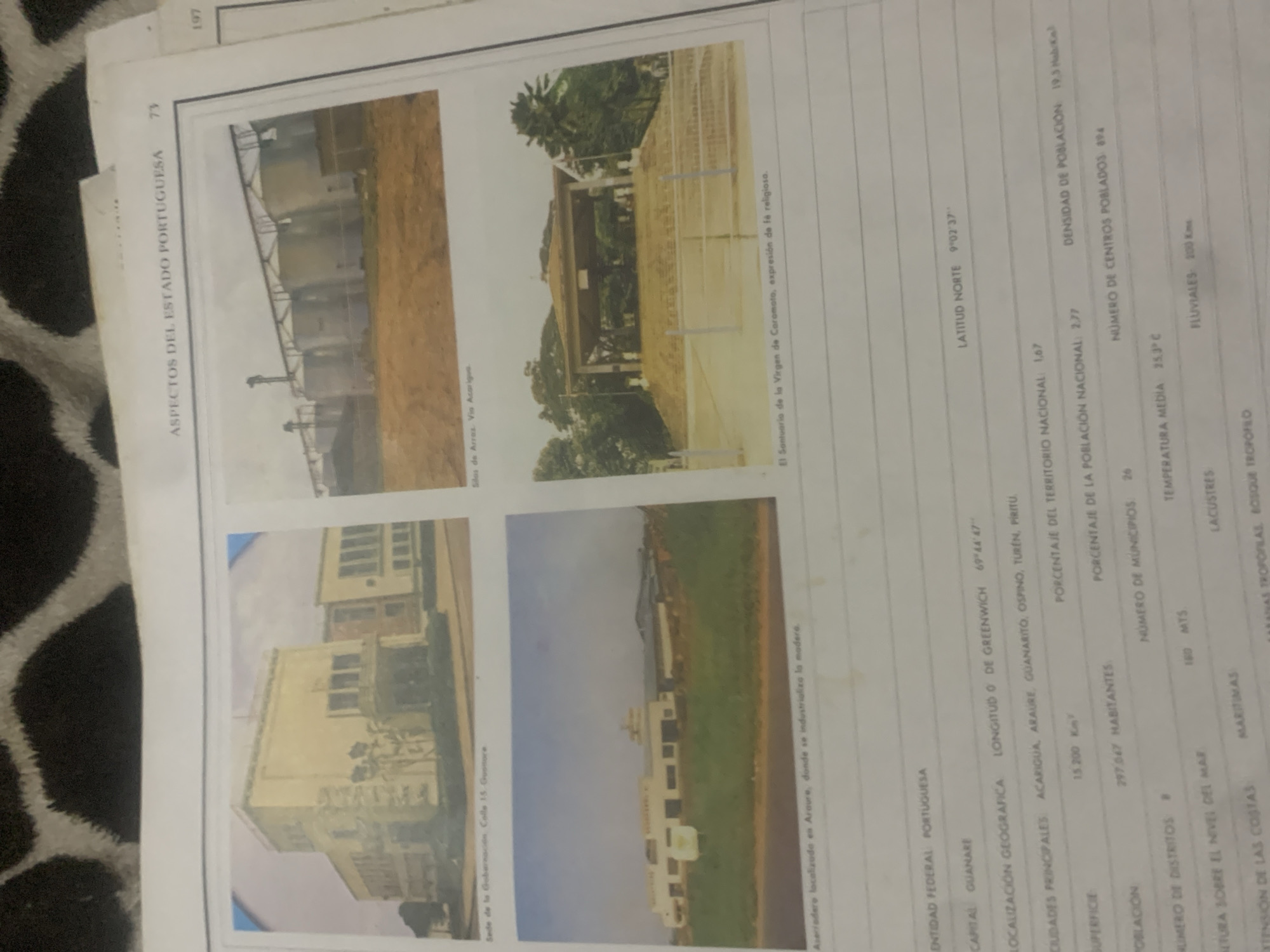
This media file showcases aspects of the Portuguese State in Venezuela, featuring four distinct photographs and accompanying text. The photographs depict various scenes and structures within the region. The top left image displays industrial silos, labeled as "Silas de Arras. Via Acarigua." The top right photograph shows a religious sanctuary, identified as "El Santuario de la Virgen de Coromoto, expresión de fe religiosa." The bottom left image presents a building, described as "Sede de la Gobernación, Calle 15 Guanare." Finally, the bottom right image features an industrial facility, noted as "Aserriadero localizado en Araure, donde se industrializa la madera."

The text provides factual information about the Portuguese State, including its federal entity, capital city (Guanare), geographical coordinates (Latitude 9°02'37" N, Longitude 0° Greenwich 69°44'47"), major cities (Acarigua, Araure, Guanarito, Ospino, Turen, Piritu), surface area (15,200 km²), national territorial percentage (1.67%), population (297,047 inhabitants), national population percentage (2.77%), population density (19.5 hab/km²), number of municipalities (26), number of populated centers (894), average temperature (25.3°C), altitude (160 meters above sea level), and features like lacustrine, maritime, and fluvial environments, as well as tropical flora and forests.

The overall presentation is informative, using visual aids to complement statistical data about the region. The photographs appear to be taken during daylight hours, with clear skies suggested by the lighting. The context implies a focus on the infrastructure, culture, and natural attributes of the Portuguese State.
bombolico

Jun 25, 2026, 2:27 PM

La Tagua, Venezuela

Stake attention in this memory

nostalgic
informative
historical
documentary
cultural

This media file showcases aspects of the Portuguese State in Venezuela, featuring four distinct photographs and accompanying text. The photographs depict various scenes and structures within the region. The top left image displays industrial silos, labeled as "Silas de Arras. Via Acarigua." The top right photograph shows a religious sanctuary, identified as "El Santuario de la Virgen de Coromoto, expresión de fe religiosa." The bottom left image presents a building, described as "Sede de la Gobernación, Calle 15 Guanare." Finally, the bottom right image features an industrial facility, noted as "Aserriadero localizado en Araure, donde se industrializa la madera." The text provides factual information about the Portuguese State, including its federal entity, capital city (Guanare), geographical coordinates (Latitude 9°02'37" N, Longitude 0° Greenwich 69°44'47"), major cities (Acarigua, Araure, Guanarito, Ospino, Turen, Piritu), surface area (15,200 km²), national territorial percentage (1.67%), population (297,047 inhabitants), national population percentage (2.77%), population density (19.5 hab/km²), number of municipalities (26), number of populated centers (894), average temperature (25.3°C), altitude (160 meters above sea level), and features like lacustrine, maritime, and fluvial environments, as well as tropical flora and forests. The overall presentation is informative, using visual aids to complement statistical data about the region. The photographs appear to be taken during daylight hours, with clear skies suggested by the lighting. The context implies a focus on the infrastructure, culture, and natural attributes of the Portuguese State.

Loading AttnAds…

transactions
revenues
stakers
Earliest
Latest
Highest stake

No transactions found

More from this user

More from La Tagua

bombolico

Jun 25, 2026, 2:27 PM

La Tagua, Venezuela

Licensed under Creative Commons Attribution 4.0 International License. You are free to share and adapt this content with proper attribution.



