
Stake attention in this memory
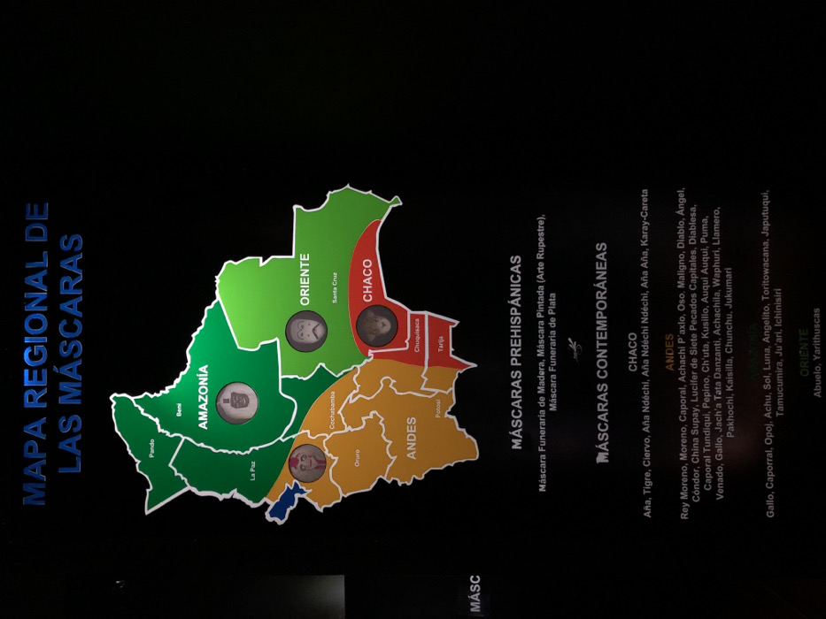
The media file displays an educational exhibit, likely from a museum or cultural center in La Paz, Bolivia, featuring a "MAPA REGIONAL DE LAS MÁSCARAS" (Regional Map of Masks). The central subject is a stylized map of Bolivia, divided into four colored regions: green for "AMAZONÍA" (Amazon), light green for "ORIENTE" (East), red for "CHACO," and orange for "ANDES." Within these regions, specific departments or cities are labeled, such as Pando, Beni, La Paz, Oruro, Cochabamba, Potosí, Chuquisaca, Tarija, and Santa Cruz. Circular inserts within the Amazonía, Oriente, Chaco, and Andes regions showcase illustrations of representative masks from those areas. Below the map, text categories detail different types of masks. "MÁSCARAS PREHISPÁNICAS" (Pre-Hispanic Masks) are described with examples like "Máscara Funeraria de Madera," "Máscara Pintada (Arte Rupestre)," and "Máscara Funeraria de Plata." "MÁSCARAS CONTEMPORÁNEAS" (Contemporary Masks) are listed by region: - "CHACO" includes Aña, Tigre, Ciervo, Aña Ndéchi, and Karay-Careta. - "ANDES" lists numerous masks such as Rey Moreno, Caporal, Diablo, Ángel, Cóndor, China Supay, Lucifer de Siete Pecados Capitales, Pepino, Ch'uta, Kusillo, Puma, and Jukumari. - "ORIENTE" features masks like Gallo, Caporral, Sol, Luna, Angelito, and Abuelo. The overall scene is a black background with illuminated text and graphics, indicating an indoor, informative display.
Loading AttnAds…
No transactions found