Stake attention in this memory
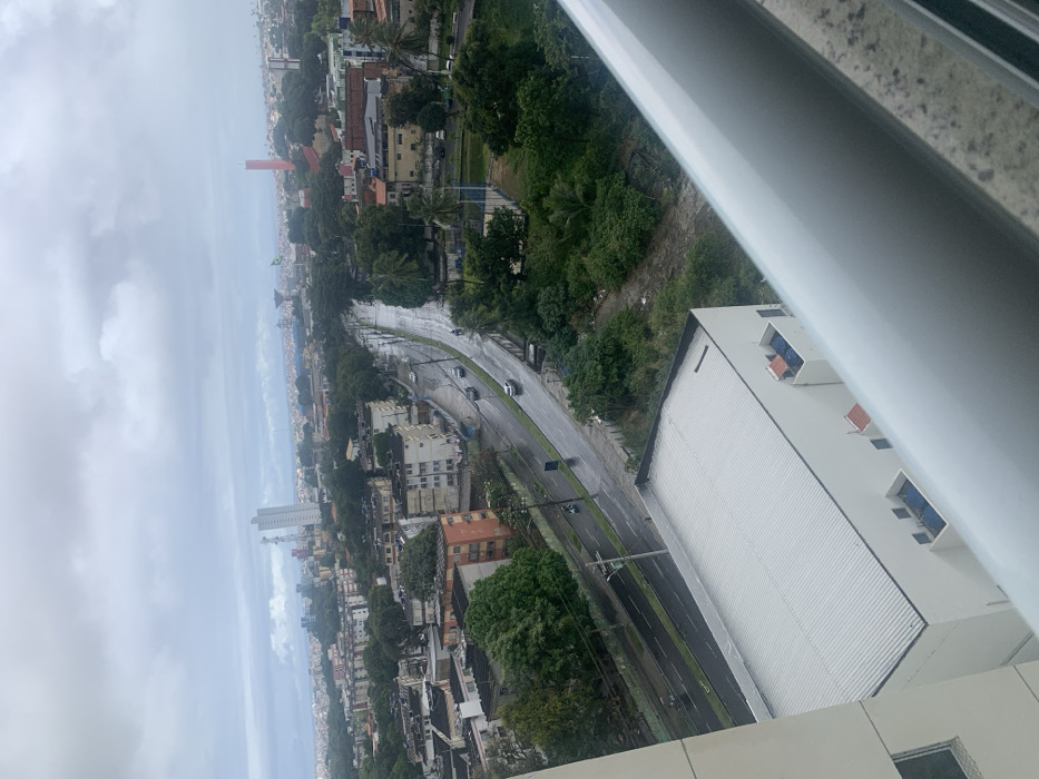
This elevated, downward-angled image captures an urban landscape in Salvador, Brazil, specifically from a high-rise building in the Brotas neighborhood, looking generally north-northeast. The scene is observed under an overcast, uniformly grey sky, with all visible road surfaces wet, indicating recent or ongoing precipitation. A wide, multi-lane asphalt road, likely a segment of Avenida Vasco da Gama or a connecting artery, curves from the lower-left to the mid-right. Several vehicles, including dark and light-colored cars and a motorcycle, are visible on the wet road; traffic appears light. Utility poles with overhead lines run alongside the road on the left. To the left of the road, a dense collection of multi-story residential buildings, primarily in faded shades of brown and off-white, populate the mid-ground, some exhibiting signs of weathering. On the right side of the road, a significant expanse of dense green foliage and trees dominates, interspersed with some unpaved ground. In the background, prominent urban landmarks are discernible: a tall, modern white high-rise building with multiple antenna structures, identifiable as the Salvador Trade Center, is visible towards the upper-left horizon. Further to the upper-right, a distinctive red water tower with a Brazilian flag attached to a pole stands against the sky. In the immediate foreground, the corrugated grey roof and white walls of a building are visible directly below the viewer, partially obscured on the far right by a white, horizontal balcony railing, confirming the elevated vantage point. No individuals are distinctly visible.
Loading AttnAds…
No transactions found