Stake attention in this memory
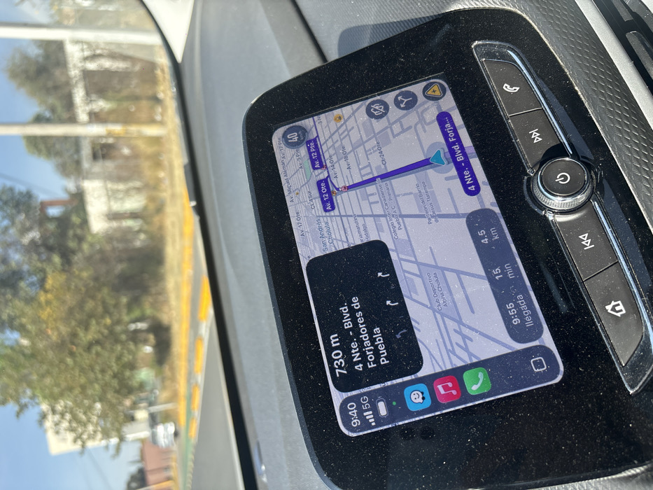
The image depicts the interior of a vehicle, specifically the dashboard and infotainment system, viewed from the driver's or front passenger's perspective. The infotainment screen displays an active navigation interface, indicating a current time of 9:40 AM. The primary navigation instruction is to proceed 730 meters to "4 Nte. - Blvd. Forjadores de Puebla." The map portion of the display clearly shows street names such as "Av. 17 Ote.", "Av. Miguel Alemán", "San Andrés Cholula", and "Av. 12 Pte.", directly placing the vehicle's location within the city of Cholula, Mexico, or its immediate vicinity. The estimated time of arrival is 9:55 AM, with 15 minutes and 4.5 kilometers remaining. A speed limit of 40 km/h is visible on the map. The screen also shows signal strength and a "5G" indicator, alongside app icons for messaging, music, and phone calls. Through the vehicle's windshield, a paved road with a green-painted bicycle lane marked by yellow raised sections or speed bumps is visible. Beyond the road, the environment consists of dry vegetation, trees, and indistinct, possibly dilapidated, structures under a clear, bright sky. A light-colored vehicle is partially visible in the distance ahead on the road. The surface of the infotainment system and the surrounding dashboard trim are visibly coated with a layer of dust. No individuals are depicted in the scene.
No transactions found