Stake attention in this memory
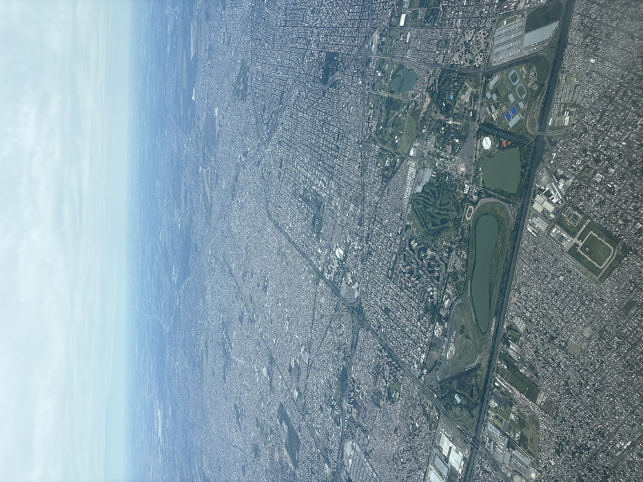
This image presents an aerial view of a densely populated urban landscape under an overcast sky, observed from an elevated position, likely an aircraft on approach to or departure from Aeropuerto Internacional Ezeiza, Argentina, looking northeast towards the city of Buenos Aires. The scene prominently features key landmarks within Buenos Aires' Palermo neighborhood in the midground and foreground. Specifically, the Hipódromo Argentino de Palermo is identifiable as a large oval race track, encircling an elongated dark green lake. Immediately to its north, a substantial green area configured as a golf course, complete with fairways and white sand traps, is visible. Adjacent to the Hipódromo's eastern side, several smaller lakes and a complex of sports facilities, including various pitches and buildings with blue and white roofs, are discernible. The surrounding urban area is characterized by a vast, intricate grid-like street pattern, densely packed with numerous low-to-mid-rise residential and commercial buildings. Major arterial roads and multi-lane highways traverse the urban fabric. In the lower-left section of the image, large industrial or commercial structures with extensive parking areas are evident. The urban development extends throughout the visible landscape, gradually becoming less distinct towards the hazy horizon. No individual people, specific vehicles, or discernible actions are visible due to the high altitude. The environment is illuminated by diffused light from an overcast sky, which appears uniformly light grey to pale blue, occupying approximately the upper third of the image. Atmospheric haze obscures distant details, creating a muted color palette dominated by greys, blues, and greens.
Loading AttnAds…
No transactions found