Stake attention in this memory
Informative
Organized
Detailed
Public Transport
Practical
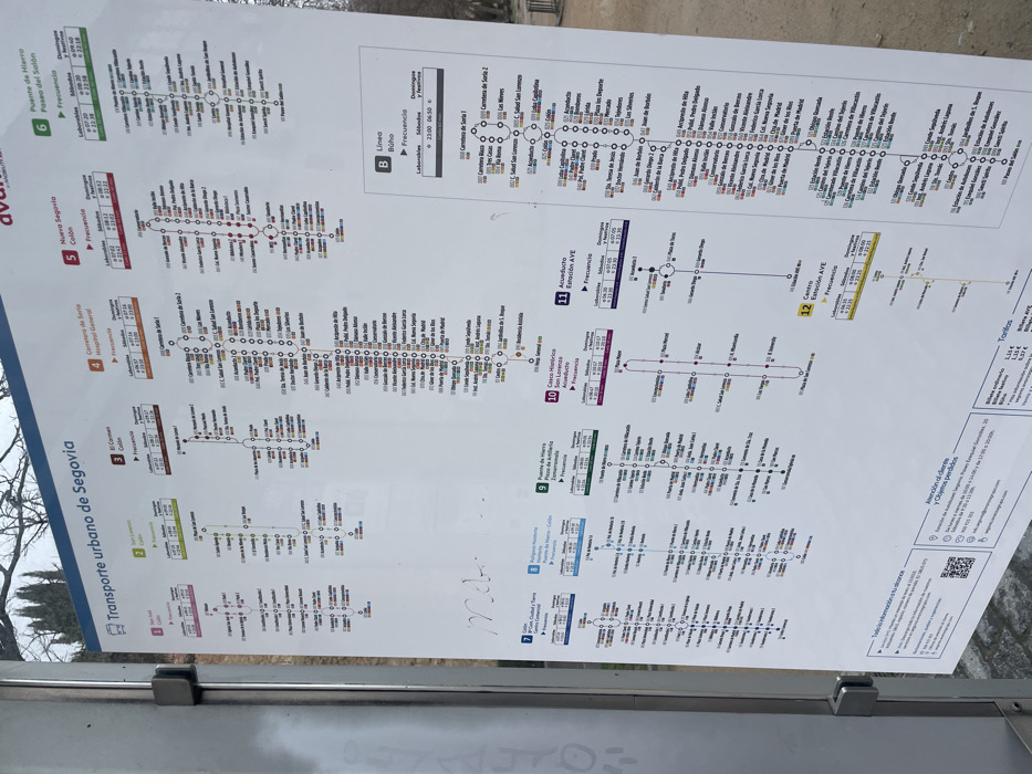
The image shows a public transportation map for Segovia, Spain, located at the coordinates 40.949, -4.124. The map is mounted on a glass or plastic panel, likely a bus stop shelter. The map depicts the bus routes for the city's public transportation system, showing the various lines, stops, and frequency of service. The map is titled "Transporte urbano de Segovia" and uses a color-coded system for each route. The map shows a total of 12 lines, labeled 1 through 12. Each line is marked with a specific color and lists the stops along the route. The map also includes information about the frequency of the bus service and the location of key stops.
transactions
revenues
stakers
Earliest
Latest
Highest stake
No transactions found