Stake attention in this memory
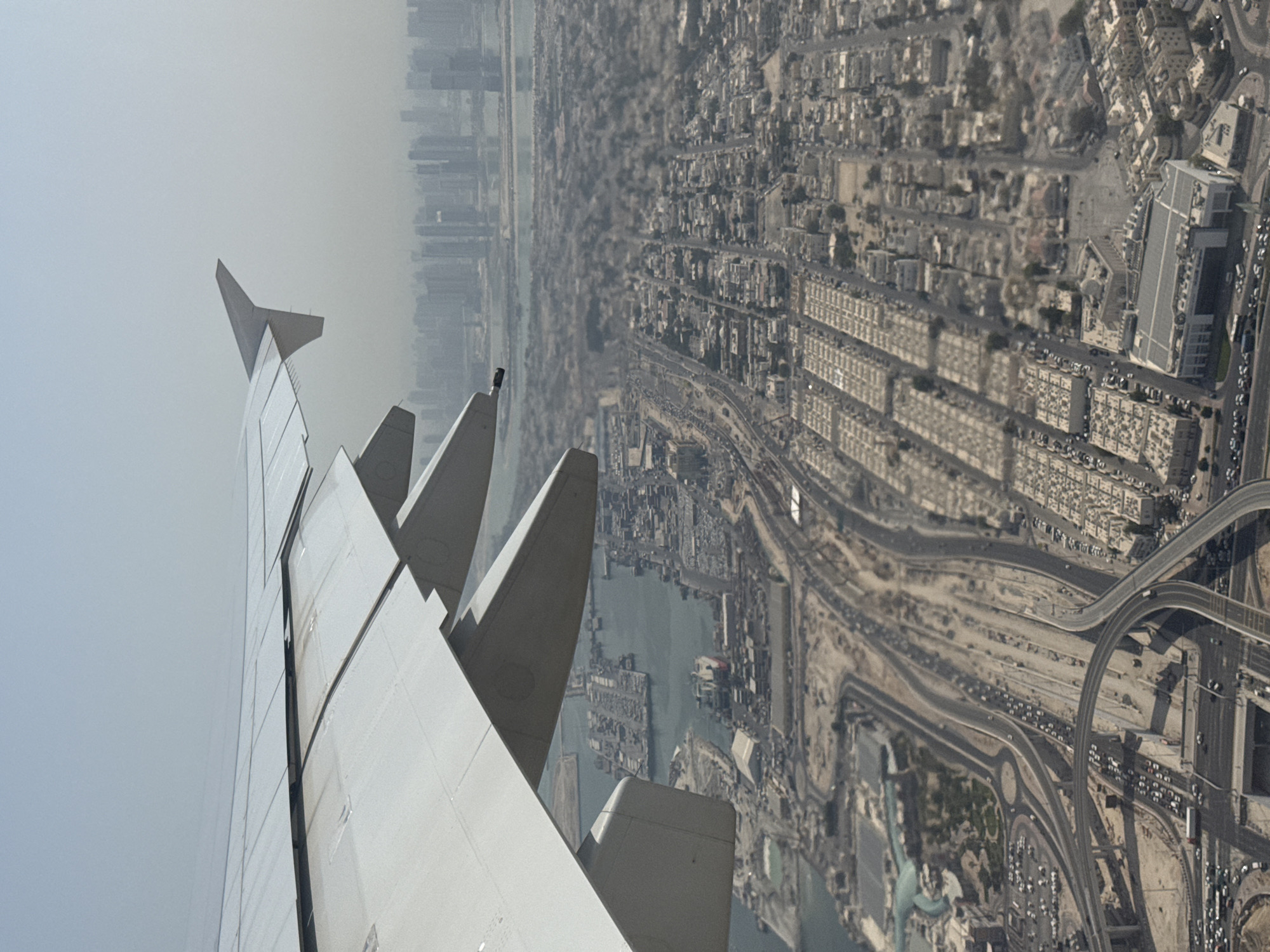
This is an aerial image of Dubai, United Arab Emirates, captured under a hazy sky. The upper-left quadrant distinctly shows the Deira district, characterized by a dense, gridded urban layout extending to the coastline. Offshore from Deira, within the Arabian Gulf, several large artificial landforms associated with the Deira Islands project are visible. The central and lower portions of the image display a vast, modern urban expanse. A prominent, meandering waterway, identified as the Dubai Water Canal/Creek, carves through the cityscape, flanked by a high concentration of contemporary skyscrapers and multi-story buildings that form a central business and residential corridor. An intricate network of multi-lane highways and extensive, multi-level interchanges connects various parts of the city. In the lower-right quadrant, curvilinear residential developments featuring distinctive artificial turquoise lagoons are observed. Towards the lower-central area, a large, dark oval-shaped track and other green, manicured spaces, likely part of a sports complex or golf course, are discernible. Patches of undeveloped sandy terrain are interspersed among the urban developments. No individual people or specific actions are resolvable due to the high altitude perspective.
Symbol
61D49
Volume
7,135
Creator
+$0.04
Revenue
+$0.00
TVL
$4.16