Stake attention in this memory
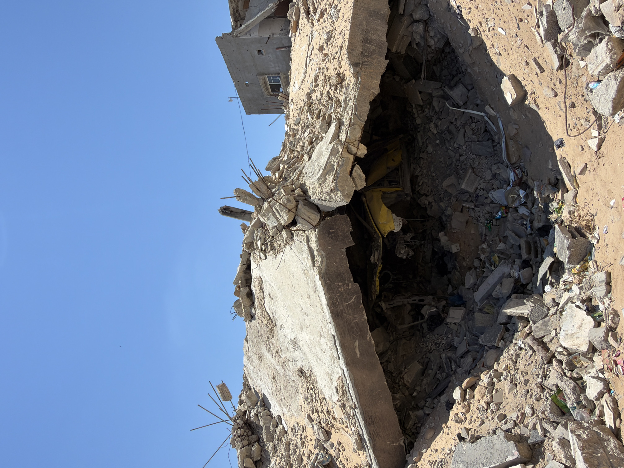
devastated
destroyed
war-torn
ruined
hopeful
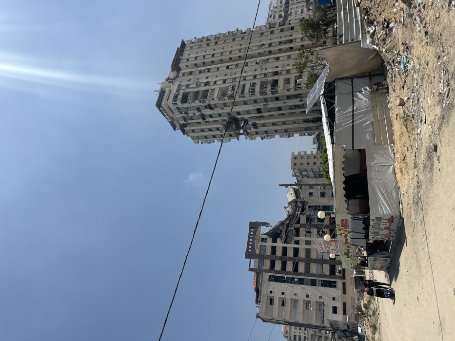
The image shows a street in Gaza City, Palestine, located at coordinates (latitude: 31.513, longitude: 34.43). The street is lined with buildings, many of which are damaged. In the foreground, there is a large tent structure, likely used as a temporary shelter. Two people, one pushing a stroller, walk on the street. The sky is clear, and there is sunlight shining through the clouds. The environment is dusty and rubble-strewn. The image depicts the aftermath of conflict and displacement.
transactions
revenues
stakers
Earliest
Latest
Highest stake
No transactions found