Stake attention in this memory
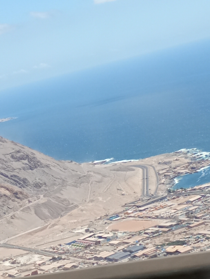
This image presents an elevated, oblique aerial view of Alto Hospicio, Chile, encompassing a coastal urban environment, arid desert terrain, and the Pacific Ocean. The upper portion of the frame features a clear, light blue sky with minimal scattered white clouds, transitioning to the vast, deep blue expanse of the ocean below. The ocean surface displays minor choppiness and visible white wave breaks along the coastline. The left side of the image is dominated by a steep, arid desert mountainside composed of light brown, rocky terrain, descending towards the sea. Unpaved tracks are discernible on these slopes. At the base of this mountain and extending along the coast, an urban area is visible, characterized by a dense cluster of buildings with various roof types and colors, primarily reddish-brown, grey, and light blue. These structures suggest a mix of residential, commercial, and industrial facilities, with several large, flat-roofed buildings indicative of warehouses or similar operations. A paved road system is prominent, including a main thoroughfare that descends from the desert plateau and curves along the coastline, leading towards a natural inlet. This inlet contains calmer, lighter blue water, suggesting a protected harbor or port facility, with associated man-made structures along its edge. Additional roads intersect throughout the urbanized zone. Interspersed among the buildings are areas of bare, light-colored earth, possibly indicative of undeveloped plots or ongoing construction. No individual people or specific activities are discernable from this high vantage point.
Symbol
634A6
Volume
1,755
Creator
+$0.07
Revenue
+$0.05
TVL
$1.63