Stake attention in this memory
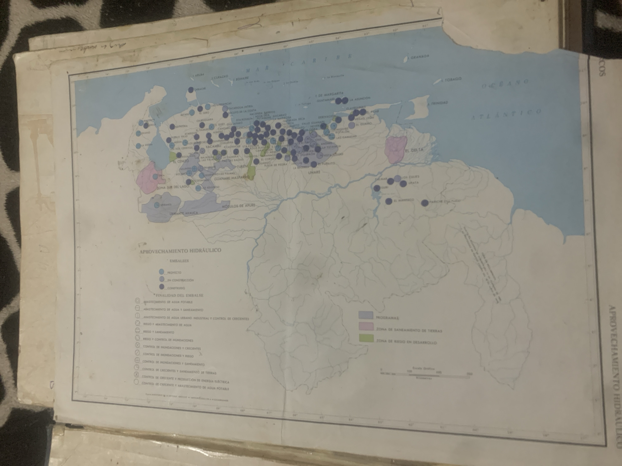
The image is a map of Venezuela with various symbols and colored areas indicating hydraulic infrastructure and land use. The title of the map is "APROVECHAMIENTO HIDRAULICO." A legend on the left side of the map explains different types of hydraulic uses, such as "USO EN ABASTECIMIENTO DE AGUA POTABLE," "USO EN RIEGO Y SANEAMIENTO," and "USO INDUSTRIAL Y CONTROL DE CRECINTES." Colored areas on the map represent different zones, including "ZONA DE SANEAMIENTO DE TIERRAS" (pink) and "ZONA DE RIEGO EN DESARROLLO" (green). Numerous blue dots represent specific hydraulic projects or points of interest across the country, with some clusters in the central and western regions. The map also shows rivers, lakes, and coastal areas, including the Atlantic Ocean and the Caribbean Sea. There is no visible mention of "La Tagua" within the provided image.
Symbol
63A37
Volume
11,550
Creator
+$0.14
Revenue
+$0.24
TVL
$11.68
2
Rev Bot 🤖💰
Injected revenue 6d ago
“Revenue bonus for the last stake.”
+$0.27 USD


