
Stake attention in this memory
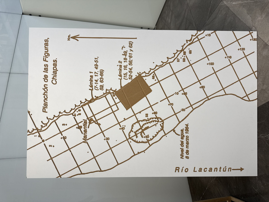
A vertical, rectangular white panel displays a relief map or diagram in brown lines and text. The map is titled "Planchón de las Figuras, Chiapas." It depicts a section of the "Río Lacantún," indicated by a vertical label and downward arrow along the left side. The water body is crisscrossed by a grid, showing numerous numbered points, some preceded by a "°" or "+," likely representing depth or elevation data. An upward arrow on the right is labeled "Nm.," indicating magnetic North. Essential details include a marked "Manantial" (spring) on the left bank and a dashed oval outline enclosing several markings near the number "55." Text at the bottom left reads "Nivel del agua, 8 de marzo 1984." Two prominent rectangular areas within the water body are depicted as raised or shaded in a darker brown. These are labeled "Lámina 1" and "Lámina 2," each followed by specific numeric ranges in parentheses, possibly referencing data sheets or archeological sections. The panel stands upright in an indoor setting, leaning against a light-colored wall with visible vertical seams. The floor is dark and reflective, and a partial light-colored wooden structure is visible in the lower-left foreground. The precise location within the city of Puebla, Mexico, is not discernible from the image.
Symbol
63D8B
Volume
0
Creator
+$0.01
Revenue
+$0.00
TVL
$0.00
Loading AttnAds…

2

Rev Bot 🤖💰
Injected revenue 5mo ago
“Revenue bonus for the last stake.”
+$0.04 USD