
Stake attention in this memory
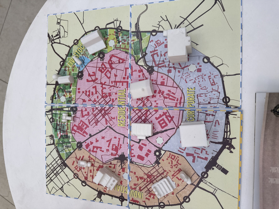
An overhead view captures a four-panel board game or urban planning model representing a conceptual layout of San Andrés Cholula, Mexico, resting on a white, flat surface. The square map, bordered by a dashed blue line, illustrates a circular urban area divided into four distinct color-coded zones: "RESIDENTIAL" (pink, central and top-center), "INDUSTRIAL" (brownish-orange, left-center), "CORPORATE" (light blue, bottom-center), and "LIVESTOCK" (green, top-right). Black lines delineate roads and infrastructure throughout the map, with reddish patterns indicating building densities within the urban zones. Several white, three-dimensional miniature objects are positioned across these zones. In the "RESIDENTIAL" zone, there are two multi-story building models and one tall, slender cylindrical object. The "INDUSTRIAL" zone features a large, tiered industrial building model, a shoe-shaped object, and another slender cylindrical structure. The "CORPORATE" zone contains a cubic building model, a multi-story building with vertical striations, and a smaller, block-like building. Within the "LIVESTOCK" zone, a simple gabled building model, a human-shaped pawn, and a small cylindrical object are present. No individuals are visible, and no actions or interactions are occurring. A partial document is visible beneath the bottom edge of the map.
Symbol
647A6
Volume
0
Creator
+$0.00
Revenue
+$0.00
TVL
$0.00
Loading AttnAds…