Sign in
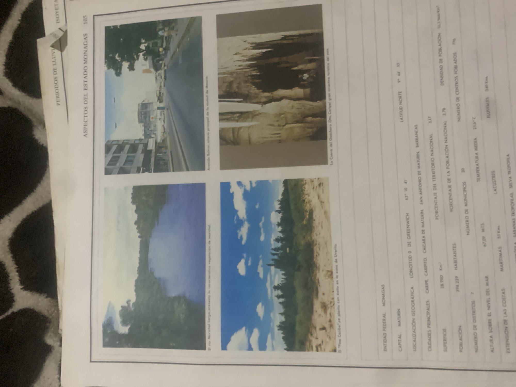
This is a page from a publication, likely a book or magazine, featuring a collection of images and textual information about the state of Monagas, Venezuela. The page is oriented vertically.

The top half of the page displays three distinct photographs arranged in a row. The first photograph on the left shows a street scene in a city, with buildings and a road. The caption beneath it reads "Avenida Bolivar, arteria principal de la ciudad de Maturin," indicating it's a view of Bolívar Avenue, the main artery of Maturín. The middle photograph captures the interior of a cave, with stalactites and stalagmites creating a dramatic natural formation. Its caption states, "La Cueva del Guacharo (Dto. Caripe) gran atractivo turistico del pais," identifying it as the Guácharo Cave in Caripe, a significant tourist attraction. The third photograph on the right is a landscape image, likely depicting a natural environment.

The bottom half of the page contains two more photographs. The left photograph shows a body of water, possibly a river, with lush green foliage along its banks and a misty or cloudy sky above. The caption reads, "El rio Morichal Largo, presenta la característica vegetación de morichal," identifying it as the Morichal Largo River with characteristic morichal vegetation. The right photograph shows a dense forest scene with a bright blue sky dotted with white clouds. Its caption is "El "Pico Caribe" se planta con éxito en la zona de Uverita," mentioning the "Pico Caribe" being successfully planted in the Uverita area.

Below the images, there is a table-like structure with various data points about the state of Monagas. This includes information on its federal entity, capital (Maturín), geographical location (longitude and latitude), principal cities, surface area, population, number of districts and municipalities, altitude, temperature, and coastline extensions (maritime, lacustrine, and fluvial). There are also categories for vegetation types like "SABANAS TROPOFILAS" and "SELVA TROPORILA." The text also mentions "PERIODOS DE LLUVI" (Rainy Periods) and "ISOYETA" at the top left, suggesting climate-related information is also present. The page is numbered "105." The overall impression is an informative piece showcasing the geography, natural attractions, and demographic data of Monagas.
bombolico

Jun 25, 2026, 2:36 PM

La Tagua, Venezuela

Moment

Stake attention in this memory

curiosity
discovery
wonder
fascination
appreciation

This is a page from a publication, likely a book or magazine, featuring a collection of images and textual information about the state of Monagas, Venezuela. The page is oriented vertically. The top half of the page displays three distinct photographs arranged in a row. The first photograph on the left shows a street scene in a city, with buildings and a road. The caption beneath it reads "Avenida Bolivar, arteria principal de la ciudad de Maturin," indicating it's a view of Bolívar Avenue, the main artery of Maturín. The middle photograph captures the interior of a cave, with stalactites and stalagmites creating a dramatic natural formation. Its caption states, "La Cueva del Guacharo (Dto. Caripe) gran atractivo turistico del pais," identifying it as the Guácharo Cave in Caripe, a significant tourist attraction. The third photograph on the right is a landscape image, likely depicting a natural environment. The bottom half of the page contains two more photographs. The left photograph shows a body of water, possibly a river, with lush green foliage along its banks and a misty or cloudy sky above. The caption reads, "El rio Morichal Largo, presenta la característica vegetación de morichal," identifying it as the Morichal Largo River with characteristic morichal vegetation. The right photograph shows a dense forest scene with a bright blue sky dotted with white clouds. Its caption is "El "Pico Caribe" se planta con éxito en la zona de Uverita," mentioning the "Pico Caribe" being successfully planted in the Uverita area. Below the images, there is a table-like structure with various data points about the state of Monagas. This includes information on its federal entity, capital (Maturín), geographical location (longitude and latitude), principal cities, surface area, population, number of districts and municipalities, altitude, temperature, and coastline extensions (maritime, lacustrine, and fluvial). There are also categories for vegetation types like "SABANAS TROPOFILAS" and "SELVA TROPORILA." The text also mentions "PERIODOS DE LLUVI" (Rainy Periods) and "ISOYETA" at the top left, suggesting climate-related information is also present. The page is numbered "105." The overall impression is an informative piece showcasing the geography, natural attractions, and demographic data of Monagas.

Symbol

647C2

Volume

0

Creator

+$0.09

Revenue

+$0.00

TVL

$0.00

1D
1W
1M
All

Loading AttnAds…

transactions
revenues
stakers
Earliest
Latest
Highest stake

1

Ramón

Staked 9d ago
Redeemed 7d ago

$7.22 USD

+$0.02 USD

Fee: $0.04 (0.5%)

+0.3%

2

Rev Bot 🤖💰

Injected revenue 9d ago

Revenue bonus for the last stake.

+$0.14 USD

More from this user

More from La Tagua

bombolico

Jun 25, 2026, 2:36 PM

La Tagua, Venezuela

Licensed under Creative Commons Attribution 4.0 International License. You are free to share and adapt this content with proper attribution.





