
Sign in
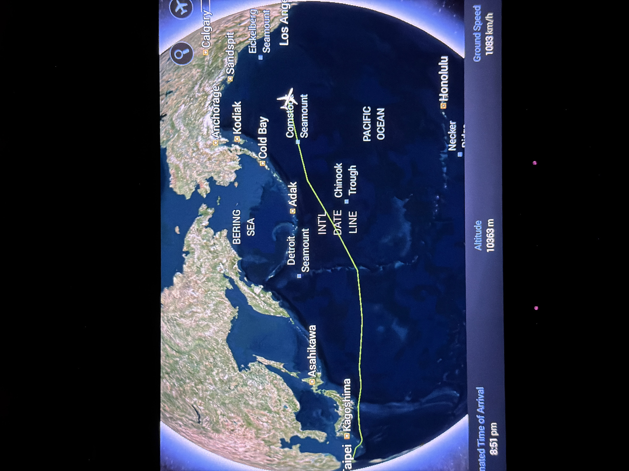
Here is a description of the image:

The image displays a flight tracking map. The flight path, indicated by a green line, originates near Taipei and Kagoshima, passes over Asahikawa, and is currently positioned over the Pacific Ocean, near Comstoc Seamount. Several cities are marked on the map including, Anchorage, Kodiak, Cold Bay, Adak, Detroit Seamount, Honolulu, Necker, Calgary, Sandspit, Eickelberg Seamount, and Los Angeles. Los Angeles appears to be in the United States of America. The flight's altitude is 10363 meters, and its ground speed is 1083 km/h. The estimated time of arrival is 8:51 pm. The map also shows the Bering Sea and the International Date Line.
Saint Roman

Mar 31, 2026, 12:35 AM

Los Angeles, USA

Stake attention in this memory

Adventure
Wonder
Awe
Excitement
Curiosity

Here is a description of the image: The image displays a flight tracking map. The flight path, indicated by a green line, originates near Taipei and Kagoshima, passes over Asahikawa, and is currently positioned over the Pacific Ocean, near Comstoc Seamount. Several cities are marked on the map including, Anchorage, Kodiak, Cold Bay, Adak, Detroit Seamount, Honolulu, Necker, Calgary, Sandspit, Eickelberg Seamount, and Los Angeles. Los Angeles appears to be in the United States of America. The flight's altitude is 10363 meters, and its ground speed is 1083 km/h. The estimated time of arrival is 8:51 pm. The map also shows the Bering Sea and the International Date Line.

Loading AttnAds…

transactions
revenues
stakers
Earliest
Latest
Highest stake

No transactions found
More from this user

More from Los Angeles

Nearby

this memory

nearby events

Saint Roman

Mar 31, 2026, 12:35 AM

Los Angeles, USA

Licensed under Creative Commons Attribution 4.0 International License. You are free to share and adapt this content with proper attribution.