Stake attention in this memory
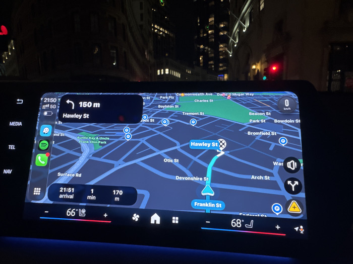
The image displays the interior of a vehicle at night, centered on its infotainment system and the view through the windshield. The infotainment screen presents a detailed navigation map for downtown Boston, Massachusetts, United States. The vehicle's current position is indicated on Franklin Street, with the navigation system directing a left turn onto Hawley Street in 150 meters. The estimated arrival time for this segment is 21:51, with 1 minute and 170 meters remaining. Prominent Boston street names visible on the map include Hawley St, Franklin St, Otis St, Devonshire St, Arch St, Bromfield St, Park St, Beacon St, Boylston St, Tremont St, Charles St, Commonwealth Ave, and David G Mugar Way, along with "Auntie Kay & Uncle Frank Chin Park." The screen also shows a 5G network signal, the current time as 21:50, and dual-zone climate controls set to 66°F and 68°F. Through the windshield, the dark background reveals several multi-story city buildings with numerous illuminated windows and a red traffic light on the right side of the frame.
Loading AttnAds…
No transactions found