Stake attention in this memory
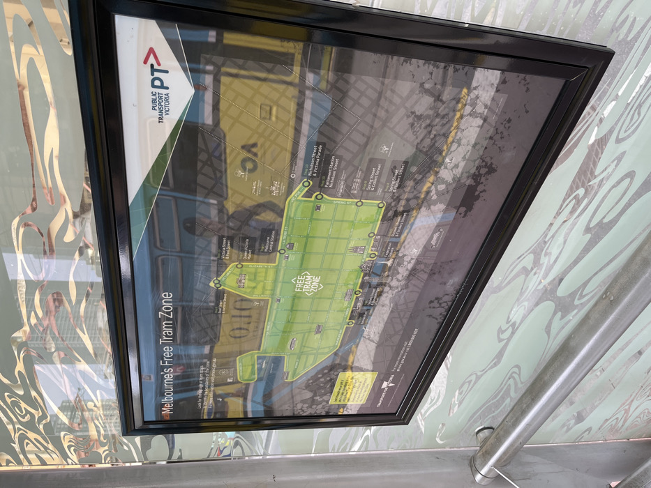
An angled, medium close-up shot captures a framed map titled "Melbourne's Free Tram Zone," prominently displayed in what appears to be a public transport shelter. The map is oriented on its side, rotated 90 degrees counter-clockwise from its intended viewing angle. The map, enclosed in a black frame, features a green-highlighted area delineating the Free Tram Zone in central Melbourne. Key streets and landmarks are visible, including "Nicholson Street & Victoria Parade," "Parliament Station Nicholson Street," "Spring Street & Collins Street," "Flinders Street," "Elizabeth St," "William St," "La Trobe St," and "Melbourne Central Station." The logo for "PUBLIC TRANSPORT VICTORIA PT>" is displayed at the top left of the map. Smaller text directs viewers to "ptv.vic.gov.au" for more information and includes "TRANSPORT FOR VICTORIA." The glass covering the map shows significant reflections, revealing blurry shapes of what might be parts of a tram, buildings, and indistinct figures, suggesting an outdoor or semi-enclosed public setting during daytime. The surface of the map also has some smudges and marks. The map is mounted against a light-colored wall with an intricate, swirling, reflective pattern. A metallic handrail or support structure is visible in the lower right foreground.
No transactions found


