
Stake attention in this memory
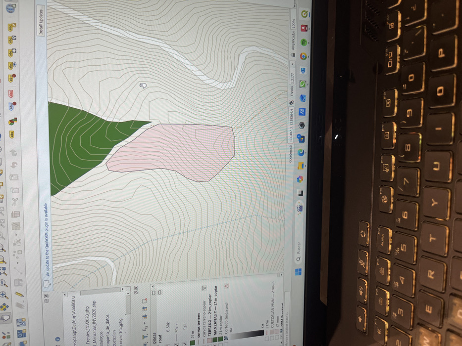
A laptop screen displays a Geographic Information System (GIS) application, specifically QGIS, presenting a digital topographic map. The map features light gray contour lines against a white background, delineating terrain. A dark green irregular polygon is visible in the upper right, and a prominent, irregular light pink polygon, partially outlined in black, occupies the central map area. White linear features, representing roads or paths, are visible traversing the map. A white mouse cursor, shaped like a pointing hand, is positioned over the light pink polygon. The left panel of the GIS interface lists active data layers, including "Frentes_INV2020.shp," "Manzanas_INV2020.shp," "places" (with "road," "0-50k," "50k+," and "Rail" sub-layers enabled), "curvas terreno," "TERRENO - 21m_copiar," and "CUETZALAN MUN - 21mun." A notification banner across the top of the application states, "An update to the QuickOSM plugin is available." The bottom status bar of the map displays "Coordenada 656407.3, 2218564.4" and "Escala 1:2177." The layer "CUETZALAN MUN - 21mun" indicates the geographic location of the mapped area as the municipality of Cuetzalan del Progreso, within the state of Puebla, Mexico. The "Manzanas_INV2020.shp" layer, which corresponds to the light pink polygon, suggests land parcel inventory data. In the foreground, the backlit keyboard of a dark laptop is visible, with keys illuminated in amber. No individuals are present in the image.
Symbol
6A1D1
Volume
0
Creator
+$0.02
Revenue
+$0.00
TVL
$0.00
Loading AttnAds…