Sign in
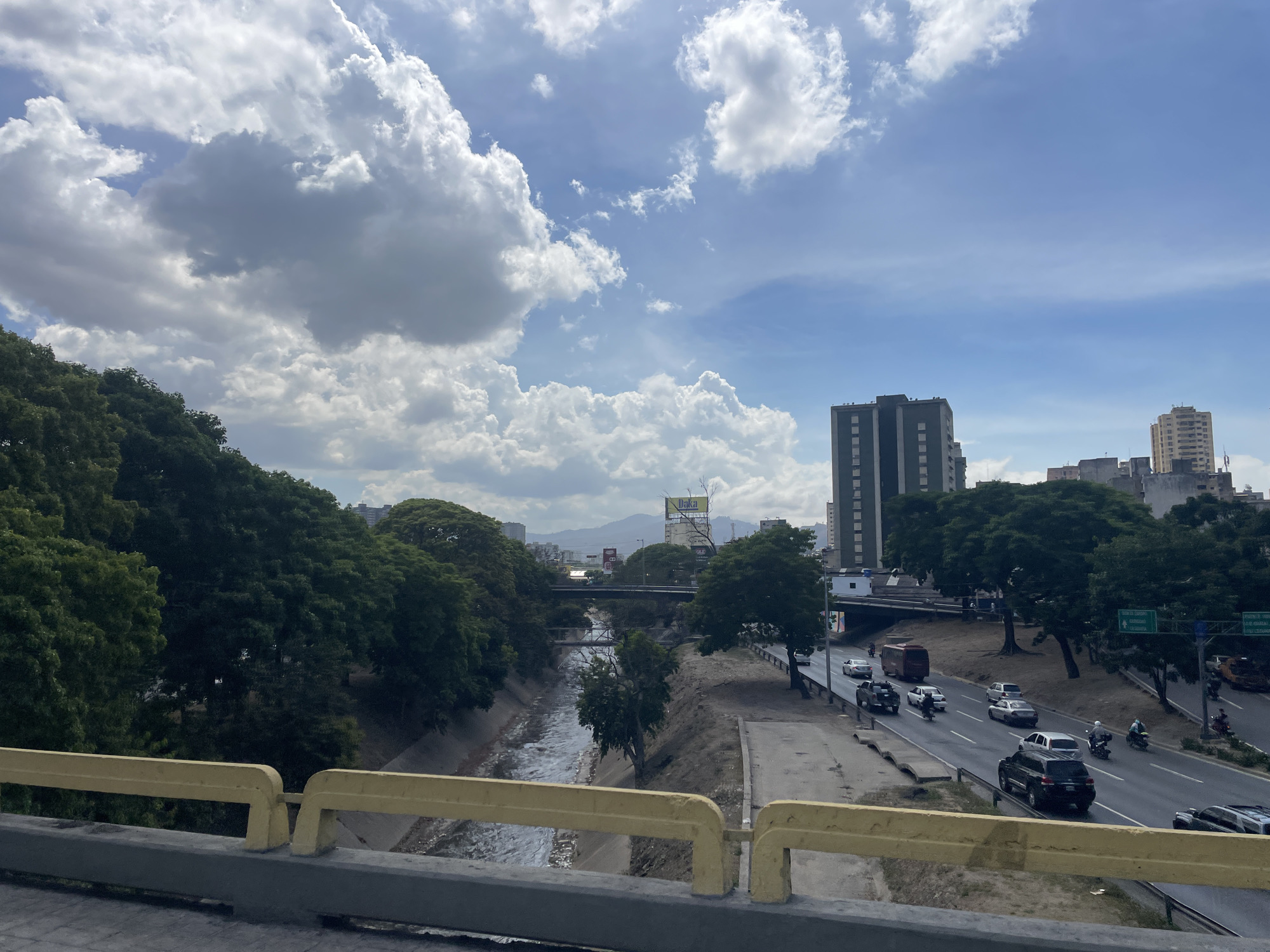
The image depicts a daytime urban landscape in Caracas, Venezuela, specifically overlooking the Autopista Francisco Fajardo and the Guaire River. In the foreground, a yellow metal bridge railing and a concrete barrier partially obscure the lower portion of the frame.

Directly beyond the railing, the Guaire River flows in a concrete-lined channel, exhibiting moderate water movement. Trees with dense green foliage line both banks of the river, extending up the slope on the left. Further down the river, two additional bridges are visible crossing the channel.

To the right of the river, the multi-lane Autopista Francisco Fajardo runs parallel, displaying active traffic. Vehicles observed include a black SUV, a white sedan, a silver sedan, a dark pickup truck, a brown bus, and multiple motorcycles, all traveling from the right side of the frame towards the left. Overhead and roadside green directional signs are visible above the highway, with text partially legible, indicating destinations related to Caracas, including "Guarairarep" (El Ávila National Park). A prominent "DAKA" billboard is situated above the highway and trees in the mid-distance.

In the background, several multi-story buildings and high-rises are present on the right, interspersed with more trees. Distant mountains, consistent with El Ávila National Park (Guarairarep), form the horizon line on the left. The sky overhead is bright blue with numerous large, white cumulus clouds.
Rockie

Mar 27, 2026, 6:21 PM

Caracas, Venezuela

Moment

Stake attention in this memory

Urban
Busy
Serene
Overcast
Contrast

The image depicts a daytime urban landscape in Caracas, Venezuela, specifically overlooking the Autopista Francisco Fajardo and the Guaire River. In the foreground, a yellow metal bridge railing and a concrete barrier partially obscure the lower portion of the frame. Directly beyond the railing, the Guaire River flows in a concrete-lined channel, exhibiting moderate water movement. Trees with dense green foliage line both banks of the river, extending up the slope on the left. Further down the river, two additional bridges are visible crossing the channel. To the right of the river, the multi-lane Autopista Francisco Fajardo runs parallel, displaying active traffic. Vehicles observed include a black SUV, a white sedan, a silver sedan, a dark pickup truck, a brown bus, and multiple motorcycles, all traveling from the right side of the frame towards the left. Overhead and roadside green directional signs are visible above the highway, with text partially legible, indicating destinations related to Caracas, including "Guarairarep" (El Ávila National Park). A prominent "DAKA" billboard is situated above the highway and trees in the mid-distance. In the background, several multi-story buildings and high-rises are present on the right, interspersed with more trees. Distant mountains, consistent with El Ávila National Park (Guarairarep), form the horizon line on the left. The sky overhead is bright blue with numerous large, white cumulus clouds.

Symbol

6C0CA

Volume

3,898

Creator

+$0.00

Revenue

+$0.00

TVL

$0.35

1D
1W
1M
All

Loading AttnAds…

transactions
revenues
stakers
Earliest
Latest
Highest stake

1

AltBot🤖

Staked 3mo ago

$0.35 USD

-$0.00 USD

-1%

More from this user

More from Caracas

Rockie

Mar 27, 2026, 6:21 PM

Caracas, Venezuela

Licensed under Creative Commons Attribution 4.0 International License. You are free to share and adapt this content with proper attribution.