Stake attention in this memory
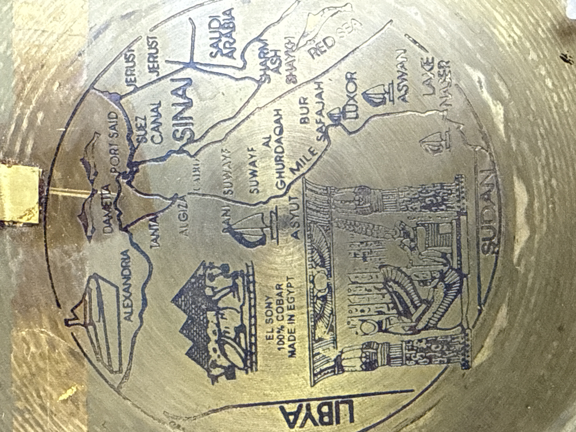
The image is a close-up, overhead shot of an engraved metal surface depicting a map of Egypt and surrounding regions. The engraving is detailed, showing geographical features, cities, and notable landmarks. Key features visible on the map include: * **Alexandria:** Depicted with a ship. * **Damietta** and **Port Said:** Labeled along the northern coast. * **Suez Canal:** Clearly marked, connecting the Mediterranean Sea to the Red Sea. * **Sinai Peninsula:** Identified and prominently featured. * **Jerusalem** (labeled as JERUST twice): Located to the east of the Sinai Peninsula. * **Saudi Arabia:** A portion of the Arabian Peninsula is shown. * **Cairo** and **Giza:** With an iconic depiction of pyramids and a camel. * **Suez** (labeled as SUWAYF and SUWAYE): Appears to be indicating Suez. * **Al Ghardaqah** and **Bur Safajah:** Coastal cities on the Red Sea. * **Luxor** and **Aswan:** Inland cities, with Aswan situated near Lake Nasser. * **Lake Nasser:** Clearly labeled. * **Red Sea:** The eastern body of water is identified. * **Sudan:** The southern part of the map extends into Sudan. * **Libya:** The western border of Egypt shows Libya. * **Hieroglyphics and Pharaoh imagery:** At the bottom left, there is a detailed engraving of ancient Egyptian temple columns and a pharaoh seated on a throne, surrounded by hieroglyphic inscriptions. * **Textual information:** Near the pyramids, there is text that reads "EL SUNY 100% COBAR MADE IN EGYPT". * **Boats/Ships:** Several small boat icons are scattered across the map, particularly on bodies of water and near coastal cities. * **Decorative Elements:** The map is bordered by a circular design, and the metal itself has a weathered, antique appearance with some areas appearing brighter, possibly due to wear or a different metal coating. A small, rectangular piece of yellow material is affixed to the top edge of the image, partially obscuring the map.
Symbol
6C2EB
Volume
3,088
Creator
+$0.02
Revenue
+$0.00
TVL
$2.10