Stake attention in this memory
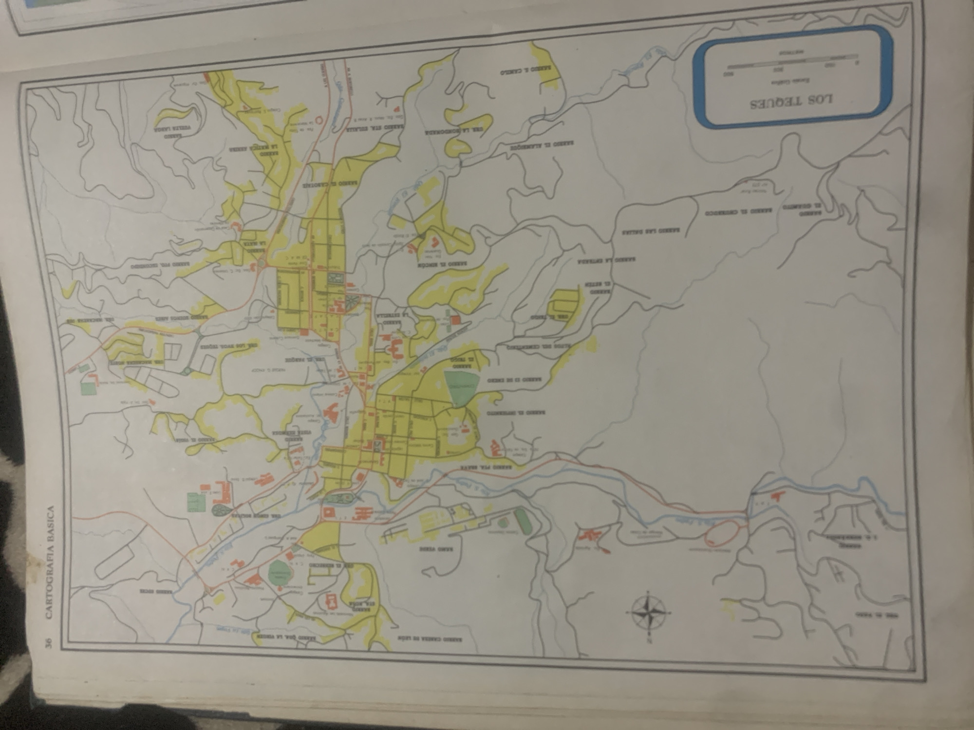
The image is a map of Los Teques, Venezuela, labeled "CARTOGRAFIA BASICA". The map is oriented with north roughly to the top right, indicated by a compass rose in the lower right portion of the image. It depicts a densely populated urban area with a grid-like street layout in the center, surrounded by more dispersed residential areas and natural terrain, characterized by hills and rivers. The map features various named barrios (neighborhoods), such as "BARRIO LAS DALIAS," "BARRIO EL ALAMBRE," and "BARRIO EL CAMILO." There are also indications of bodies of water, represented by blue lines, and roads, shown in red and grey. Some buildings are depicted with red or orange outlines, suggesting their presence on the map. In the upper right corner, a blue-bordered box contains a scale with markings for "METROS," indicating distances of 0, 200, 400, 600, and 800. This box also has the title "LOS TEQUES" prominently displayed. The overall style of the map suggests it is an older, possibly printed, document. The page number "36" is visible in the lower left corner, and the text "CARTOGRAFIA BASICA" runs vertically along the left edge. The image appears to be a scan or photograph of a page from a book or atlas. There are no people or specific events depicted, but the map itself serves as a representation of a specific geographical location. The lighting suggests it was taken indoors under artificial light, as there are some glare and shadows visible.
Symbol
6D2AE
Volume
11,550
Creator
+$0.13
Revenue
+$0.17
TVL
$11.28
2
Rev Bot 🤖💰
Injected revenue 6d ago
“Revenue bonus for the last stake.”
+$0.19 USD