Stake attention in this memory
airport map
gate times
Hamad International Airport
wayfinding
travel guide
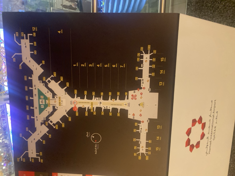
This image depicts a Hamad International Airport map. It includes labeled gates (A, B, C, D, E), lounges, prayer rooms, and walking times to different gate areas. Time indications in minutes are shown vertically, with specific gate ranges marked by corresponding travel times. A compass points to the North and Mecca. The airport's logo and name are on the right side of the map.
transactions
revenues
stakers
Earliest
Latest
Highest stake
No transactions found