Sign in
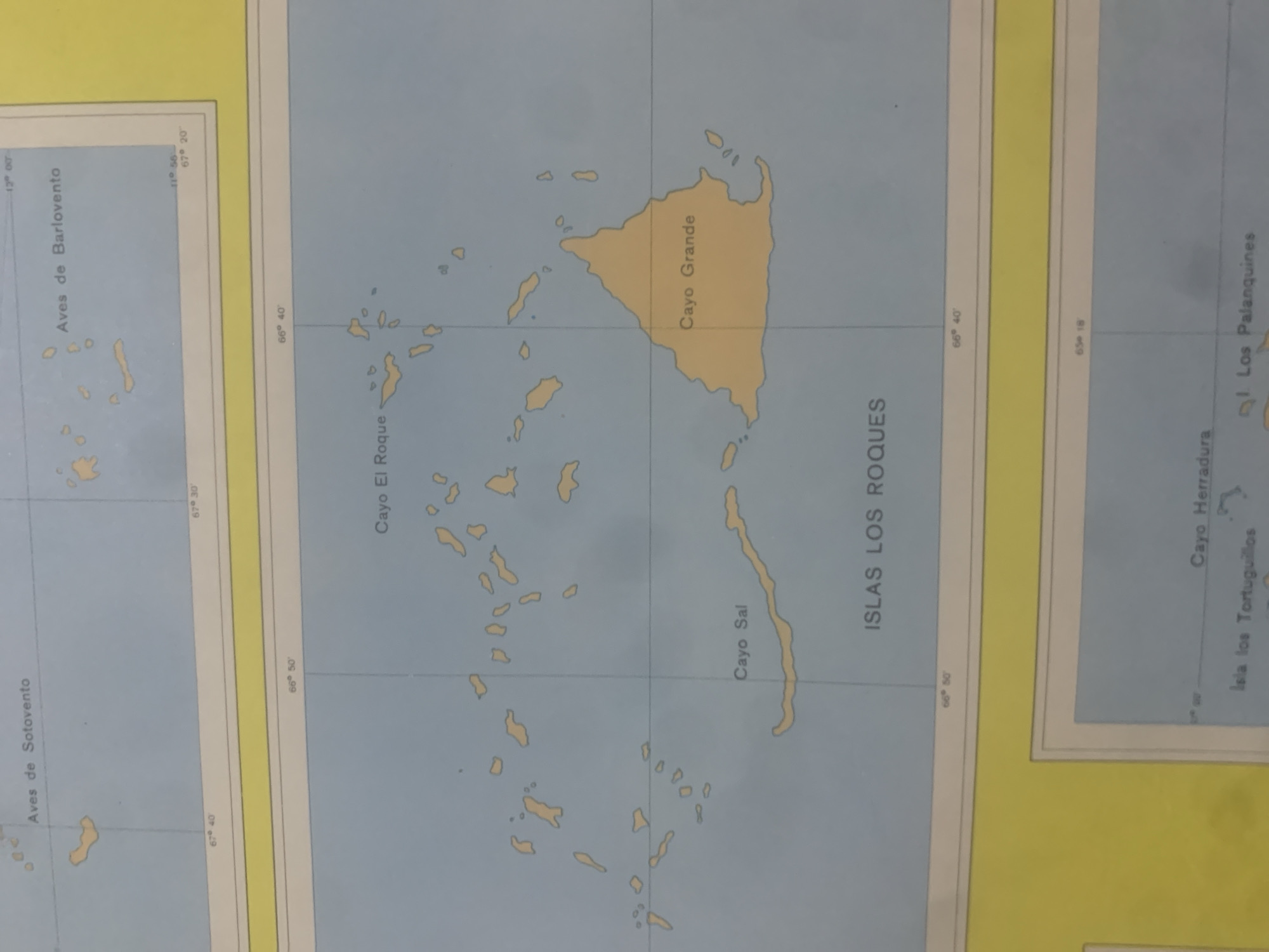
This is a photograph of a map, likely a nautical chart, showing a cluster of islands. The map displays geographical information with labels in Spanish, indicating various islands and points of interest.

The main focus is on a group of islands labeled "ISLAS LOS ROQUES". Within this group, prominent islands are identified as "Cayo Grande" and "Cayo Sal". To the west, another set of islands is labeled "Aves de Sotovento" and further west, "Aves de Barlovento". To the east, islands labeled "Cayo Herradura" and "Isla los Tortuguillos" are visible, along with a location named "Los Palanquines".

The map includes latitude and longitude markings, with longitude lines running vertically and latitude lines horizontally. The longitude appears to be in degrees and minutes, with values like 67° 40', 66° 50', 66° 40', and 65° 18'. Latitude is also indicated, with values like 12° 00' and 11° 56'.

The islands are depicted in a light yellow or ochre color against a light blue background, representing the sea. The overall scene is a cartographic representation of an archipelago, likely within a tropical or subtropical region given the names and appearance. There are no people or discernible weather conditions depicted, as it is a map. The image itself is a photograph of this map, and the quality suggests it might have been taken in natural or artificial light, with some glare or reflections visible. The text is clearly legible in Spanish. The provided location context suggests this map depicts islands off the coast of La Tagua, Venezuela.
bombolico

Jun 25, 2026, 2:43 PM

La Tagua, Venezuela

BLOCKED

Stake attention in this memory

calm
curious
analytical
nostalgic
serene

This is a photograph of a map, likely a nautical chart, showing a cluster of islands. The map displays geographical information with labels in Spanish, indicating various islands and points of interest. The main focus is on a group of islands labeled "ISLAS LOS ROQUES". Within this group, prominent islands are identified as "Cayo Grande" and "Cayo Sal". To the west, another set of islands is labeled "Aves de Sotovento" and further west, "Aves de Barlovento". To the east, islands labeled "Cayo Herradura" and "Isla los Tortuguillos" are visible, along with a location named "Los Palanquines". The map includes latitude and longitude markings, with longitude lines running vertically and latitude lines horizontally. The longitude appears to be in degrees and minutes, with values like 67° 40', 66° 50', 66° 40', and 65° 18'. Latitude is also indicated, with values like 12° 00' and 11° 56'. The islands are depicted in a light yellow or ochre color against a light blue background, representing the sea. The overall scene is a cartographic representation of an archipelago, likely within a tropical or subtropical region given the names and appearance. There are no people or discernible weather conditions depicted, as it is a map. The image itself is a photograph of this map, and the quality suggests it might have been taken in natural or artificial light, with some glare or reflections visible. The text is clearly legible in Spanish. The provided location context suggests this map depicts islands off the coast of La Tagua, Venezuela.

Symbol

6E1DB

Volume

11,550

Creator

+$0.08

Revenue

+$0.11

TVL

$7.26

1D
1W
1M
All

Loading AttnAds…

transactions
revenues
stakers
Earliest
Latest
Highest stake

1

Ramón

Staked 10d ago

$7.22 USD

+$0.04 USD

+0.5%

2

Rev Bot 🤖💰

Injected revenue 10d ago

Revenue bonus for the last stake.

+$0.12 USD

More from this user

More from La Tagua

bombolico

Jun 25, 2026, 2:43 PM

La Tagua, Venezuela

Licensed under Creative Commons Attribution 4.0 International License. You are free to share and adapt this content with proper attribution.





