
Stake attention in this memory
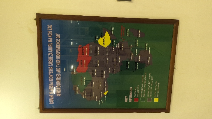
A framed map hangs on a cream wall in a building at the location of -6.166 latitude and 39.2 longitude in Zanzibar, Tanzania. The map depicts the continent of Africa with country borders outlined in black and a green background. The map is titled in English and Swahili, "Africa Countries and Their Independence Day". The map details the independence day of each African country with the dates noted in white on a colored background for each country. The countries are color-coded, with red representing a revolution, dark green representing a military confrontation, purple representing a peaceful dialogue, and yellow representing countries that were not colonized. Beneath the map is a key explaining the color-coded system. The key is also labeled in English and Swahili. "Ufungo" means "Key". The map is framed with a brown wooden frame and a glass covering. The building's interior is not otherwise visible.
Loading AttnAds…
No transactions found