Stake attention in this memory
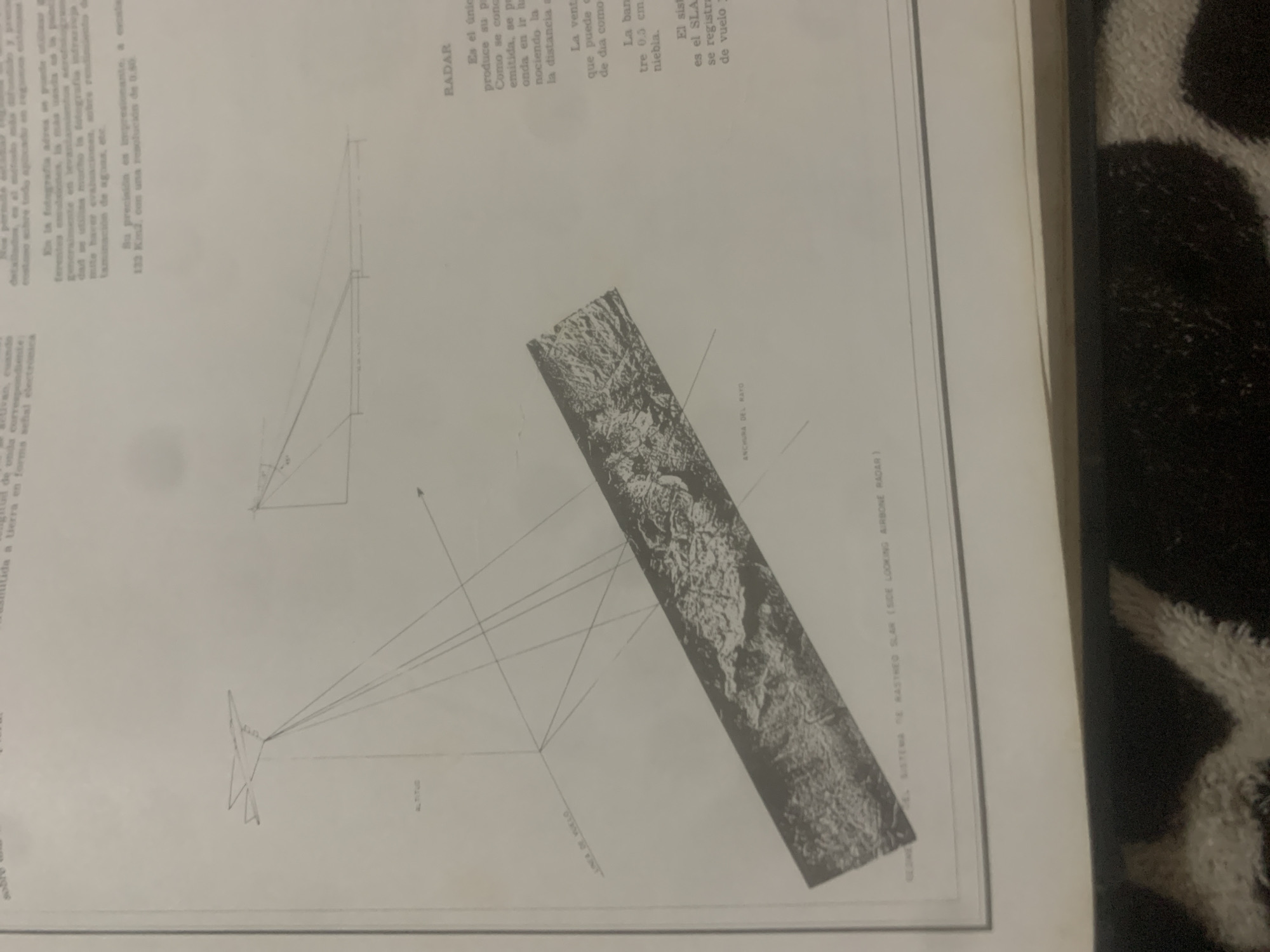
This media file appears to be a page from a technical document or book, featuring diagrams and a satellite or aerial image. The primary subject matter revolves around radar technology, specifically Side Looking Airborne Radar (SLAR). The document contains two diagrams illustrating the principles of radar operation. The first diagram shows a simplified representation of radar waves being emitted from an aircraft and reflecting off the ground. The second diagram, more detailed, depicts an aircraft emitting a radar beam and its path to the ground, along with the "ANCHURA DEL RAYO" (beam width) and "ALTITUD" (altitude). A prominent feature is a diagonal image of a mountainous or rugged terrain, identified as a "SIDE LOOKING AIRBORNE RADAR" image. This image showcases the capabilities of the SLAR system to capture detailed topographical information. Visible text in Spanish provides technical explanations related to radar. It mentions that radar is the only system that produces its own illumination, allowing it to operate regardless of weather conditions like fog, and that it can provide detailed information over vast areas with high resolution, citing an example of 0.50 resolution over 132 km². The text also touches upon applications such as environmental studies and water contamination detection. The overall setting is a printed page, suggesting an educational or informational context related to remote sensing and radar technology. There are no people or specific time of day or weather cues evident, beyond the implied ability of radar to overcome atmospheric conditions. The location context "La Tagua, Venezuela" is not visually depicted in the provided image but is given as context for the media file.
Symbol
71B55
Volume
11,550
Creator
+$0.03
Revenue
+$0.04
TVL
$2.39
Loading AttnAds…

2

Rev Bot 🤖💰
Injected revenue 2mo ago
“Revenue bonus for the last stake.”
+$0.04 USD





