
Sign in
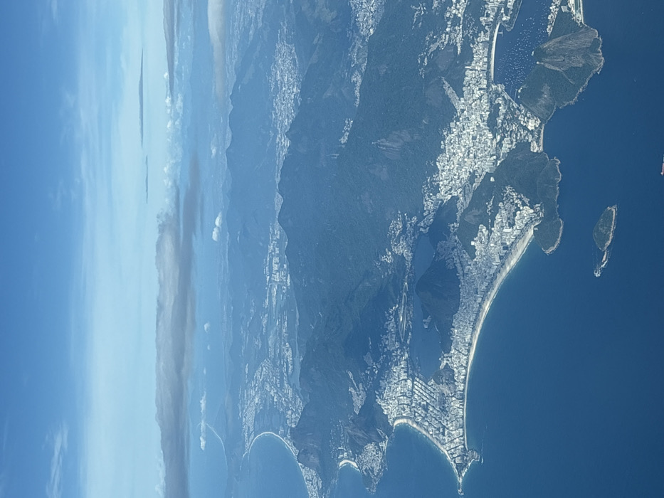
The image displays an aerial, high-altitude panoramic view of the coastal city of Rio de Janeiro, Brazil. The upper portion of the frame is occupied by a light blue sky with scattered white and grey cloud formations at various elevations. Below, the deep blue Atlantic Ocean covers the lower left and foreground.

The prominent coastline is characterized by several extensive, crescent-shaped sandy beaches, notably Copacabana and Ipanema, which are densely bordered by high-rise urban buildings forming a continuous strip of development. Inland from these coastal areas, a large, dark blue body of water, the Lagoa Rodrigo de Freitas, is clearly visible. The urban sprawl extends further inland, integrating with and ascending numerous verdant, forested mountains and hills that form the city's rugged topography. Distinctive natural landmarks include Sugarloaf Mountain, identifiable on the right side of the image, marking the entrance to a bay where several small white vessels are observed. Along the distant coastline on the far left, a faint linear feature, consistent with a highway or bridge, extends into the horizon. No specific individuals or discernible actions are visible at this altitude; the scene focuses on the natural geography and human-made infrastructure.
luciannex

Dec 15, 2025, 12:04 PM

Aeropuerto Internacional Ezeiza, Argentina

Moment

Stake attention in this memory

Awe
Wonder
Serenity
Peacefulness
Adventure

The image displays an aerial, high-altitude panoramic view of the coastal city of Rio de Janeiro, Brazil. The upper portion of the frame is occupied by a light blue sky with scattered white and grey cloud formations at various elevations. Below, the deep blue Atlantic Ocean covers the lower left and foreground. The prominent coastline is characterized by several extensive, crescent-shaped sandy beaches, notably Copacabana and Ipanema, which are densely bordered by high-rise urban buildings forming a continuous strip of development. Inland from these coastal areas, a large, dark blue body of water, the Lagoa Rodrigo de Freitas, is clearly visible. The urban sprawl extends further inland, integrating with and ascending numerous verdant, forested mountains and hills that form the city's rugged topography. Distinctive natural landmarks include Sugarloaf Mountain, identifiable on the right side of the image, marking the entrance to a bay where several small white vessels are observed. Along the distant coastline on the far left, a faint linear feature, consistent with a highway or bridge, extends into the horizon. No specific individuals or discernible actions are visible at this altitude; the scene focuses on the natural geography and human-made infrastructure.

Symbol

7214E

Volume

5,567

Creator

+$0.01

Revenue

+$0.00

TVL

$0.61

1D
1W
1M
All

Loading AttnAds…

transactions
revenues
stakers
Earliest
Latest
Highest stake

1

AltBot🤖

Staked 7mo ago

$0.56 USD

-$0.01 USD

-1%

3

TAGBOT🤖🏷

Staked 7mo ago

$0.03 USD

-$0.00 USD

-1%

2

TAGBOT🤖🏷

Staked 7mo ago

$0.03 USD

-$0.00 USD

-1%

More from this user

More from Aeropuerto Internacional Ezeiza

luciannex

Dec 15, 2025, 12:04 PM

Aeropuerto Internacional Ezeiza, Argentina

Licensed under Creative Commons Attribution 4.0 International License. You are free to share and adapt this content with proper attribution.