Stake attention in this memory
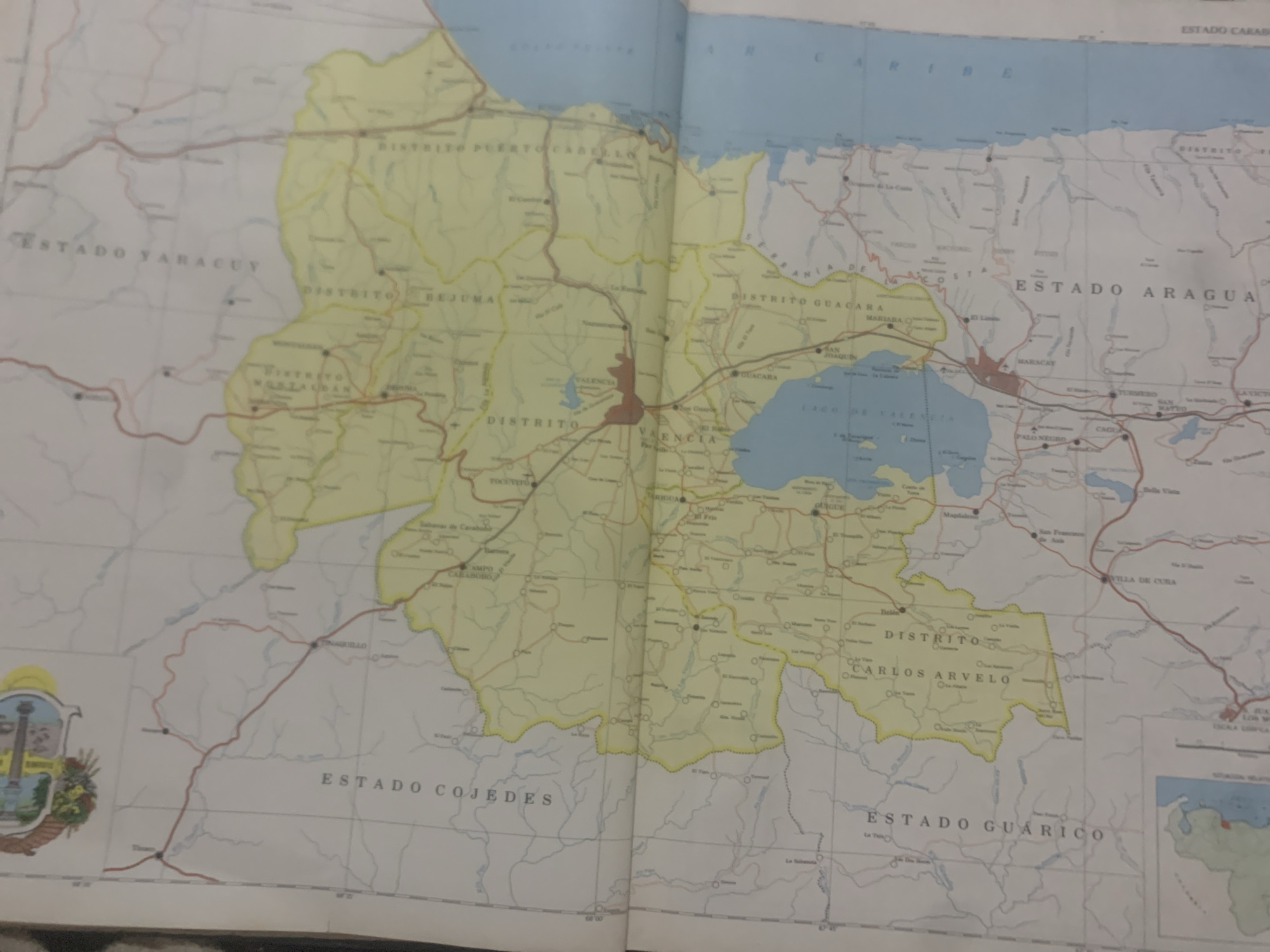
This media file is a photograph of an open map, likely a geographical or political map of a region in Venezuela. The map displays various administrative divisions, roads, towns, and geographical features such as a lake. The prominent text visible includes names of states like "ESTADO YARACUY", "ESTADO ARAGUA", and "ESTADO GUARICO", as well as districts like "DISTRITO PUERTO CABELLO", "DISTRITO BEJUMA", and "DISTRITO GUACARA". The map also labels cities such as "VALENCIA", "MARACAY", and "LA TAGUA", with "LA TAGUA" being a specific location cue. The map is colored, with a distinct yellow highlighting indicating a particular administrative area. There are also road networks depicted in red and black lines. A coat of arms or emblem is visible on the lower left side of the map. The overall scene is static, depicting a document laid open. The lighting suggests an indoor setting, possibly under artificial light, as there are no strong shadows or indications of natural daylight. The quality of the image is slightly blurry, typical of a photograph taken without professional equipment.
Symbol
731EE
Volume
11,550
Creator
+$0.14
Revenue
+$0.26
TVL
$11.64
2
Rev Bot 🤖💰
Injected revenue 6d ago
“Revenue bonus for the last stake.”
+$0.29 USD


