Stake attention in this memory
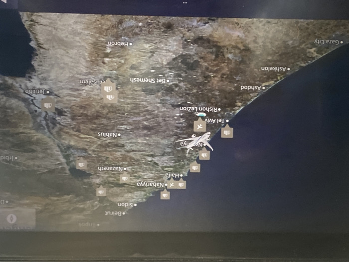
This image displays an in-flight map on an electronic screen, depicting the Eastern Mediterranean region. The map shows the coastline of Israel and parts of Lebanon, with the dark blue Mediterranean Sea on the left (west) and a detailed landmass to the right (east). Numerous cities are labeled, including Beirut, Sidon, Nahariyya, Haifa, Netanya, Tel Aviv, Rishon LeZion, Ashdod, Ashkelon, and Gaza City along the coast, and Nazareth, Nablus, Jerusalem, Jericho, Bet Shemesh, Hebron, and Irbid inland. Several generic building icons and specific airport icons (airplane symbol within a square) are placed near various locations. A white silhouette of an airplane is positioned over the Mediterranean Sea, west-southwest of Tel Aviv and west of Rishon LeZion. A smaller, light blue teardrop-shaped marker with a white cross, indicating the current position, is located just south of the aircraft icon, west of Rishon LeZion. The city of Or Yehuda, Israel, is not explicitly labeled on this map. Geographically, Or Yehuda is situated inland, east-southeast of Tel Aviv and northeast of Rishon LeZion. The displayed aircraft is located over the Mediterranean Sea, approximately west-northwest of Or Yehuda's estimated position. The screen itself shows reflections from ambient light, indicating its surface.
No transactions found