
Sign in
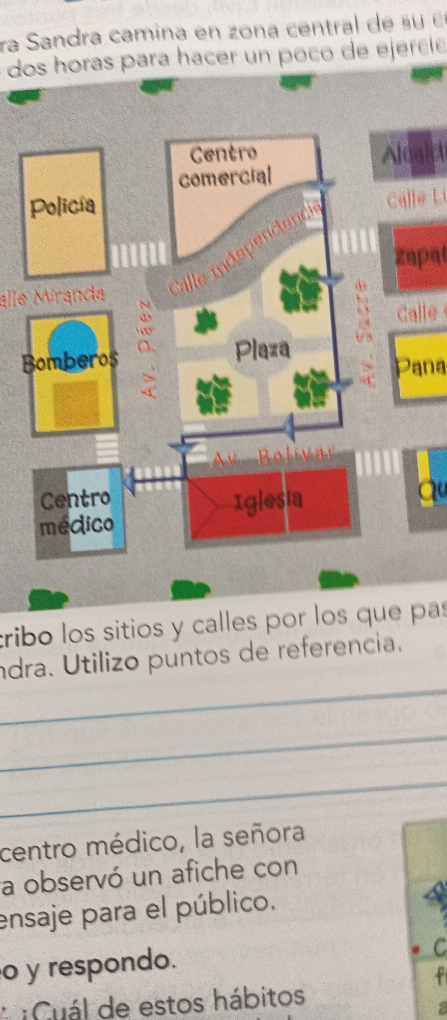
This media file is an image of a page from a workbook or textbook featuring a map of a town with some text. The map depicts various locations such as a police station ("Policia"), a fire station ("Bomberos"), a commercial center ("Centro comercial"), a plaza, a church ("Iglesia"), and a medical center ("Centro médico"). Streets are labeled, including "Av. Páez," "Calle Independencia," "Av. Sacre," and "Av. Bolívar." The illustration is in a cartoonish style with colored blocks representing buildings and green shapes for trees.

Above the map, there is text in Spanish that translates to "Sandra walks in a central area of her c... two hours to exercise a bit." Below the map, there is more Spanish text that reads "I describe the places and streets she passes through. Sandra. I use reference points." Further down, another section of text says "medical center, the lady observed a poster with a message for the public." Finally, there is a question that translates to "and respond. Which of these habits."

The overall scene suggests an educational activity focused on navigation and description using a map, likely for a Spanish language class or a geography lesson. The time of day and weather are not indicated. The emotions of any people are not discernible as no people are clearly depicted. The location context "La Tagua, Venezuela" likely refers to the fictional town depicted in the map.
Ramón

Jun 23, 2026, 1:24 PM

La Tagua, Venezuela

Short Term

Stake attention in this memory

academic
instructive
analytical
organized
neutral

This media file is an image of a page from a workbook or textbook featuring a map of a town with some text. The map depicts various locations such as a police station ("Policia"), a fire station ("Bomberos"), a commercial center ("Centro comercial"), a plaza, a church ("Iglesia"), and a medical center ("Centro médico"). Streets are labeled, including "Av. Páez," "Calle Independencia," "Av. Sacre," and "Av. Bolívar." The illustration is in a cartoonish style with colored blocks representing buildings and green shapes for trees. Above the map, there is text in Spanish that translates to "Sandra walks in a central area of her c... two hours to exercise a bit." Below the map, there is more Spanish text that reads "I describe the places and streets she passes through. Sandra. I use reference points." Further down, another section of text says "medical center, the lady observed a poster with a message for the public." Finally, there is a question that translates to "and respond. Which of these habits." The overall scene suggests an educational activity focused on navigation and description using a map, likely for a Spanish language class or a geography lesson. The time of day and weather are not indicated. The emotions of any people are not discernible as no people are clearly depicted. The location context "La Tagua, Venezuela" likely refers to the fictional town depicted in the map.

Symbol

742DC

Volume

5,833

Creator

+$0.07

Revenue

+$0.04

TVL

$2.94

1D
1W
1M
All

Loading AttnAds…

transactions
revenues
stakers
Earliest
Latest
Highest stake

1

Jesús José

Staked 16d ago
Redeemed 15d ago

$2.93 USD

+$0.02 USD

Fee: $0.03 (1%)

+0.6%

2

Rev Bot 🤖💰

Injected revenue 16d ago

Revenue bonus for the last stake.

+$0.06 USD

3

RIKO

Staked 16d ago

$2.93 USD

+$0.01 USD

+0.3%

4

Rev Bot 🤖💰

Injected revenue 16d ago

Revenue bonus for the last stake.

+$0.07 USD

More from this user

More from La Tagua

Ramón

Jun 23, 2026, 1:24 PM

La Tagua, Venezuela

Licensed under Creative Commons Attribution 4.0 International License. You are free to share and adapt this content with proper attribution.