Sign in
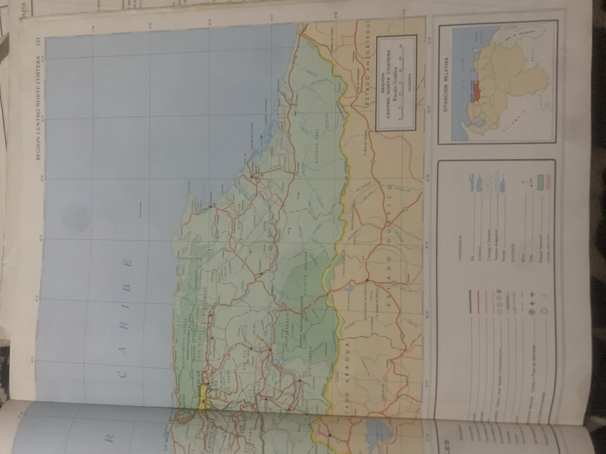
The media file is a photograph of an open map of Venezuela, specifically the "REGION CENTRO NORTE COSTERA" and "ESTADO ANZOÁTEGUI". The map is detailed, showing rivers, roads, cities, national parks, and administrative boundaries. The text on the map is predominantly in Spanish, with place names like "CARACAS", "PETARE", "TO SUCRE", and "DISTRITO ACEVEDO". There is also a "SITUACIÓN RELATIVA" inset map showing Venezuela in a regional context, with the focus area highlighted in red. A "LEYENDA" (legend) provides symbols for different map features such as rivers, highways, and towns. The map is well-lit, and the details are clear, suggesting it is a photograph taken in daylight. The overall scene is that of a cartographic document, likely from an atlas or a large map collection, displayed on a flat surface. There are no people or animals visible in the image. The focus is solely on the map and its contents. The page number "131" is visible in the top right corner. The image is slightly tilted, with the bottom edge of the map visible. The approximate location "La Tagua, Venezuela" is mentioned, which could be inferred from the map itself or from external context provided for this image.
bombolico

Jun 25, 2026, 2:45 PM

La Tagua, Venezuela

BLOCKED

Stake attention in this memory

nostalgic
analytical
scholarly
focused
reflective

The media file is a photograph of an open map of Venezuela, specifically the "REGION CENTRO NORTE COSTERA" and "ESTADO ANZOÁTEGUI". The map is detailed, showing rivers, roads, cities, national parks, and administrative boundaries. The text on the map is predominantly in Spanish, with place names like "CARACAS", "PETARE", "TO SUCRE", and "DISTRITO ACEVEDO". There is also a "SITUACIÓN RELATIVA" inset map showing Venezuela in a regional context, with the focus area highlighted in red. A "LEYENDA" (legend) provides symbols for different map features such as rivers, highways, and towns. The map is well-lit, and the details are clear, suggesting it is a photograph taken in daylight. The overall scene is that of a cartographic document, likely from an atlas or a large map collection, displayed on a flat surface. There are no people or animals visible in the image. The focus is solely on the map and its contents. The page number "131" is visible in the top right corner. The image is slightly tilted, with the bottom edge of the map visible. The approximate location "La Tagua, Venezuela" is mentioned, which could be inferred from the map itself or from external context provided for this image.

Symbol

77B98

Volume

0

Creator

+$0.09

Revenue

+$0.00

TVL

$0.00

1D
1W
1M
All

Loading AttnAds…

transactions
revenues
stakers
Earliest
Latest
Highest stake

1

Ramón

Staked 10d ago
Redeemed 9d ago

$7.23 USD

+$0.03 USD

Fee: $0.07 (1%)

+0.4%

2

Rev Bot 🤖💰

Injected revenue 10d ago

Revenue bonus for the last stake.

+$0.20 USD

More from this user

More from La Tagua

bombolico

Jun 25, 2026, 2:45 PM

La Tagua, Venezuela

Licensed under Creative Commons Attribution 4.0 International License. You are free to share and adapt this content with proper attribution.





