Stake attention in this memory
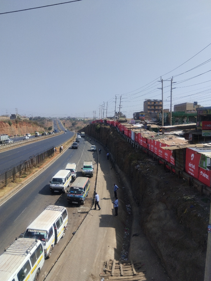
An overhead view depicts a segment of a highway in Witeithie ward, Kenya, under a clear, bright sky. The scene is bisected by a prominent multi-lane asphalt highway on the left, running from the foreground into the distant background with an ascending incline. This highway features a dark metal barrier separating its main lanes from a wide shoulder or service lane. Several white minibusses and other vehicles are present on the highway, with some individuals walking near the shoulder. To the right, a parallel, narrower paved road or service lane runs alongside a steep, unkempt dirt embankment. On this lower road, multiple minibusses are parked or moving slowly; notable vehicles include several white minibusses and one blue and white minibus. Approximately five to six adult males are visible on this road and near the embankment; most wear light-colored shirts and dark pants. Two individuals stand close to the embankment, while others walk along the roadside, some appearing to interact with the parked vehicles. At the bottom right of the frame, a makeshift structure of wooden planks and logs lies on the dirt at the base of the embankment. Above the embankment, numerous utility poles with overhead power lines stretch horizontally across the image. A row of informal commercial structures, characterized by corrugated iron roofs and prominent red "Airtel" branding, lines the top of the embankment. Behind these structures, multi-story buildings, consistent with residential or mixed-use developments, are visible against the skyline. The embankment itself shows signs of erosion and scattered debris. The overall environment suggests a bustling peri-urban area with active transportation and commercial activity bordering a major thoroughfare.
No transactions found