
Sign in
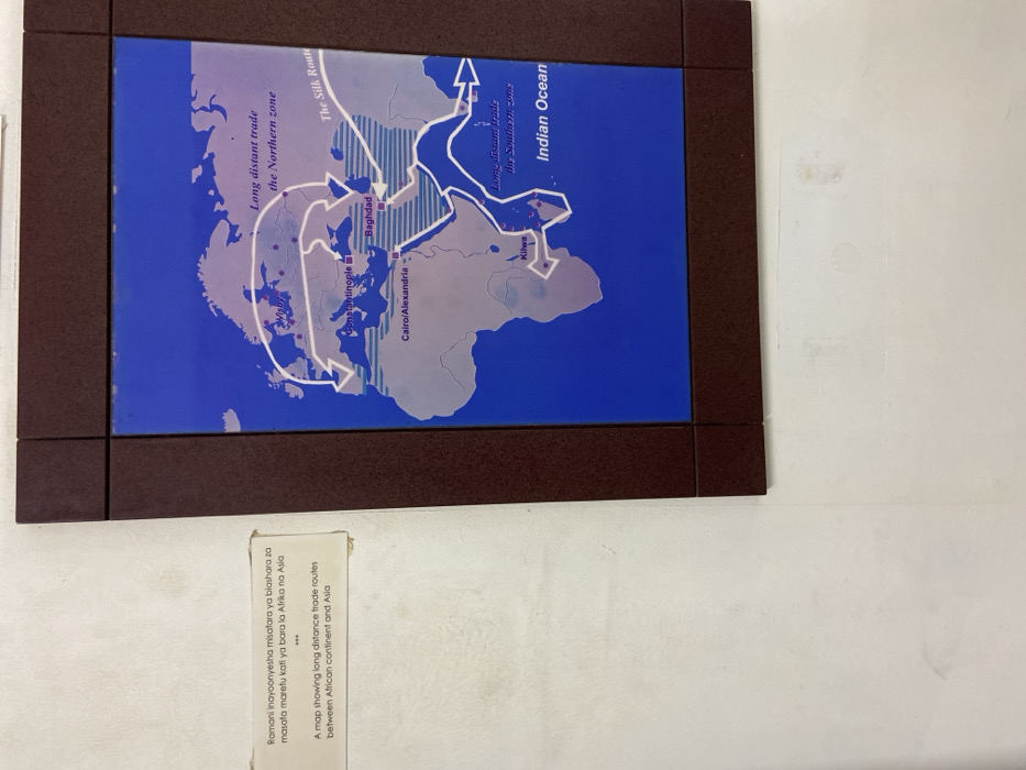
The image depicts a map of the world, displayed on a wall in a museum or educational institution in Dar es Salaam, Tanzania. The map focuses on ancient trade routes between Africa and Asia. The map is blue, and a brown frame surrounds it. It shows the Silk Route, the Northern Zone, and the Southern Zone of long-distance trade. The map is labeled in English and Swahili, and some of the key cities are highlighted. The text below the map reads, "Ramani inayoonyesha misatara ya biashara za masofa marefu kati ya bara la Afrika na Asia." This translates to "A map showing long distance trade routes between African continent and Asia." The surrounding wall is white.
FM-hlmC83

Apr 12, 2025, 10:17 AM

Dar es Salaam, Tanzania

Stake attention in this memory

historical
educational
informative
ancient
geographical

The image depicts a map of the world, displayed on a wall in a museum or educational institution in Dar es Salaam, Tanzania. The map focuses on ancient trade routes between Africa and Asia. The map is blue, and a brown frame surrounds it. It shows the Silk Route, the Northern Zone, and the Southern Zone of long-distance trade. The map is labeled in English and Swahili, and some of the key cities are highlighted. The text below the map reads, "Ramani inayoonyesha misatara ya biashara za masofa marefu kati ya bara la Afrika na Asia." This translates to "A map showing long distance trade routes between African continent and Asia." The surrounding wall is white.

Loading AttnAds…

transactions
revenues
stakers
Earliest
Latest
Highest stake

No transactions found

More from this user

More from Dar es Salaam

FM-hlmC83

Apr 12, 2025, 10:17 AM

Dar es Salaam, Tanzania

Licensed under Creative Commons Attribution 4.0 International License. You are free to share and adapt this content with proper attribution.