
Stake attention in this memory
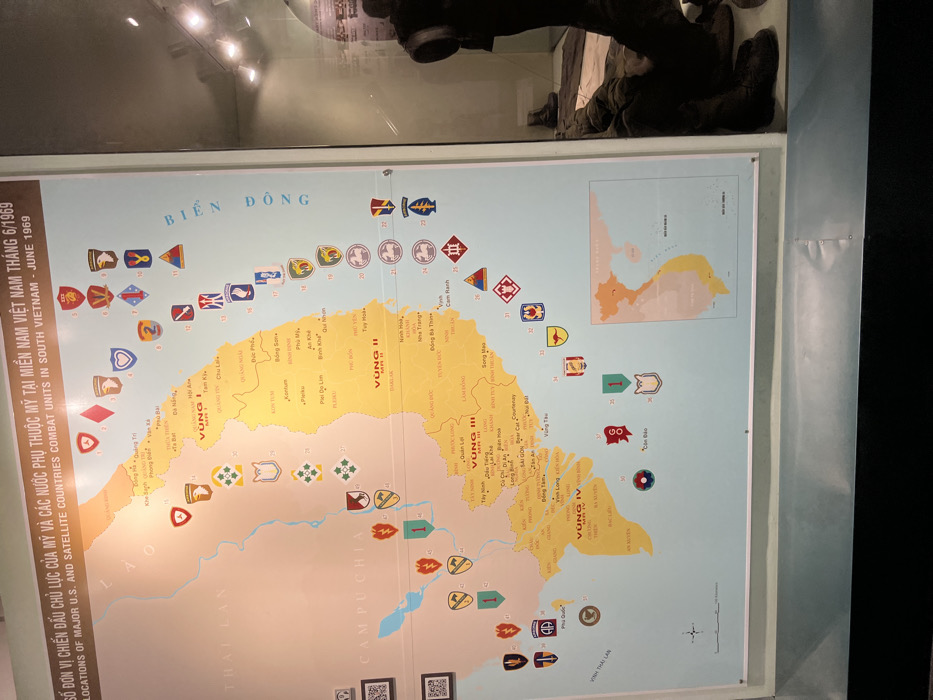
This image captures a vertically oriented display map detailing military unit locations in South Vietnam, likely housed within a museum in Ho Chi Minh City, Vietnam. The map, protected under a reflective surface, shows glare from overhead lights and a dark, indistinct reflection of what appears to be a person and a display item in the upper right. The central subject is a historical map titled "SỐ ĐƠN VỊ CHIẾN ĐẤU CHỦ LỰC CỦA MỸ VÀ CÁC NƯỚC PHỤ THUỘC MỸ TẠI MIỀN NAM VIỆT NAM THÁNG 6/1969" and its English translation: "LOCATIONS OF MAJOR U.S. AND SATELLITE COUNTRIES COMBAT UNITS IN SOUTH VIETNAM - JUNE 1969". The map outlines the geographical features of South Vietnam, divided into four tactical zones: "VÙNG I" (MR I), "VÙNG II" (MR II), "VÙNG III" (MR III), and "VÙNG IV" (MR IV). Bordering countries like "THÁI LAN" (Thailand) and "CAMPUCHIA" (Cambodia) are also labeled, alongside the "BIỂN ĐÔNG" (East Sea/South China Sea) to the east and "VINH THÁI LAN" (Gulf of Thailand) to the southwest. Various cities and provinces are marked, including Đà Nẵng, Huế, Quy Nhơn, Pleiku, Nha Trang, Cam Ranh, Sài Gòn (Saigon), and Vũng Tàu. Scattered across the map are numerous colorful military unit patches or insignia, each accompanied by a number, indicating the deployment of specific U.S. and allied combat units during June 1969. Examples include the 1st Cavalry Division, 101st Airborne Division, and units identified with Marine and various Infantry Division insignias. The overall activity portrayed is the historical mapping of military deployments, providing a visual record of the Vietnam War period.
Loading AttnAds…
No transactions found