
Sign in
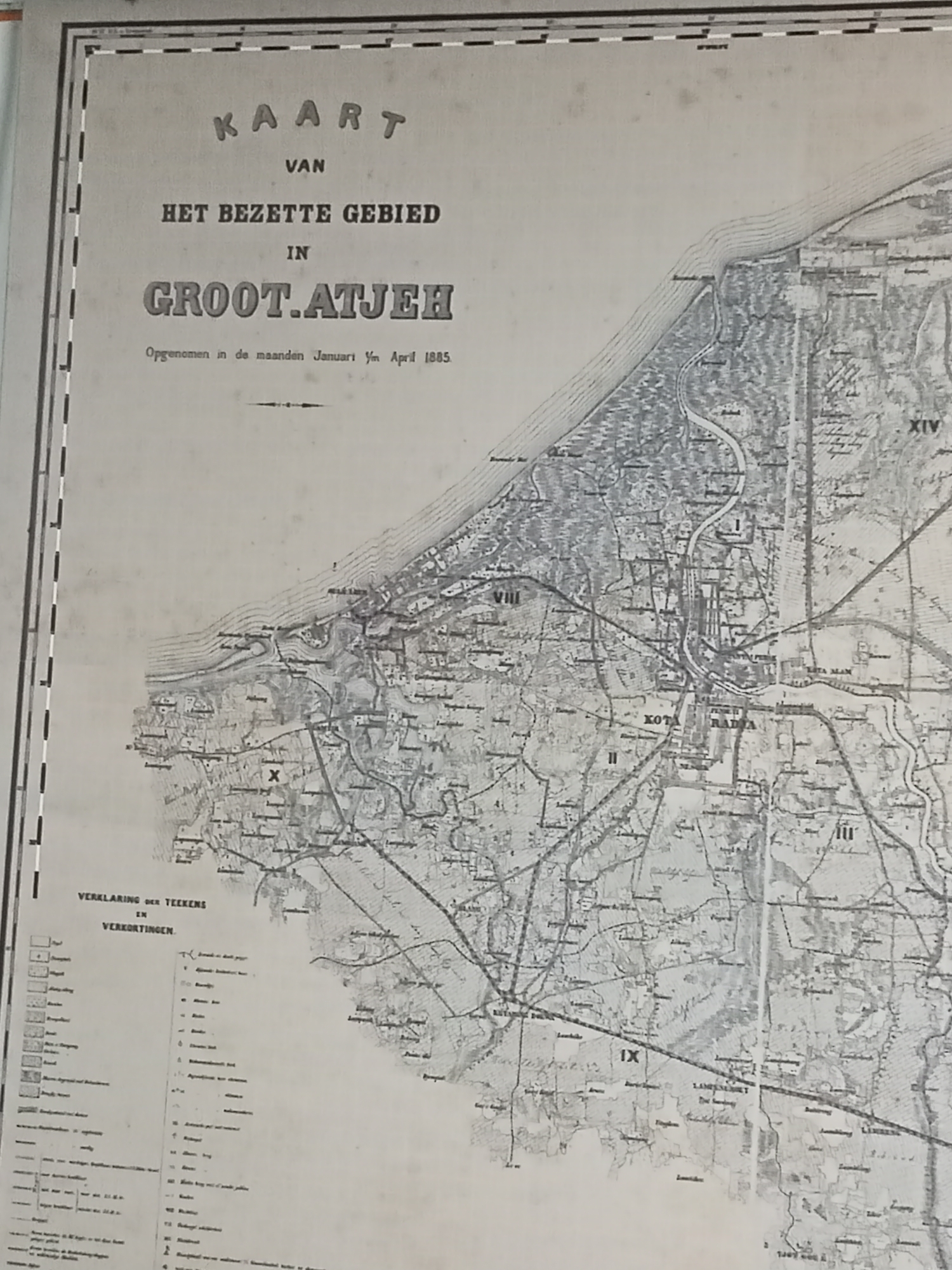
This is a scanned, monochrome historical map titled "KAART VAN HET BEZETTE GEBIED IN GROOT.ATJEH," meaning "Map of the Occupied Territory in Great Aceh." The map was compiled in January to April 1885. The geographic area depicted is likely the region of Aceh, Sumatra, Indonesia, specifically focusing on "Groot-Atjeh" or Greater Aceh, which would encompass the capital city of Banda Aceh and its surrounding territories.

The map shows a detailed topographical representation of the land, with contour lines indicating elevation. Various settlements are marked with names, and a network of roads and possibly rivers are visible, indicating infrastructure and natural features of the area. Several Roman numerals (I, II, III, VIII, IX, XIV) are present, likely indicating different zones or districts within the occupied territory. A legend or "VERKLARING DER TEEKENS EN VERKORTINGEN" (Explanation of Signs and Abbreviations) is partially visible on the lower left of the map, containing symbols and their corresponding meanings, which would have been used to denote different types of geographical features, settlements, or military installations. The map's style is typical of late 19th-century cartography, with fine linework and textual annotations. There are no people or contemporary objects depicted in the image itself, as it is a representation of a historical geographic area. The environment shown is a historical landscape of Aceh.
curisea

Jun 10, 2026, 8:29 PM

Banda Aceh, Indonesia

Moment

Stake attention in this memory

historical
detailed
geographic
vintage
informative

This is a scanned, monochrome historical map titled "KAART VAN HET BEZETTE GEBIED IN GROOT.ATJEH," meaning "Map of the Occupied Territory in Great Aceh." The map was compiled in January to April 1885. The geographic area depicted is likely the region of Aceh, Sumatra, Indonesia, specifically focusing on "Groot-Atjeh" or Greater Aceh, which would encompass the capital city of Banda Aceh and its surrounding territories. The map shows a detailed topographical representation of the land, with contour lines indicating elevation. Various settlements are marked with names, and a network of roads and possibly rivers are visible, indicating infrastructure and natural features of the area. Several Roman numerals (I, II, III, VIII, IX, XIV) are present, likely indicating different zones or districts within the occupied territory. A legend or "VERKLARING DER TEEKENS EN VERKORTINGEN" (Explanation of Signs and Abbreviations) is partially visible on the lower left of the map, containing symbols and their corresponding meanings, which would have been used to denote different types of geographical features, settlements, or military installations. The map's style is typical of late 19th-century cartography, with fine linework and textual annotations. There are no people or contemporary objects depicted in the image itself, as it is a representation of a historical geographic area. The environment shown is a historical landscape of Aceh.

Loading AttnAds…

transactions
revenues
stakers
Earliest
Latest
Highest stake

No transactions found

More from this user

More from Banda Aceh

curisea

Jun 10, 2026, 8:29 PM

Banda Aceh, Indonesia

Licensed under Creative Commons Attribution 4.0 International License. You are free to share and adapt this content with proper attribution.