
Stake attention in this memory
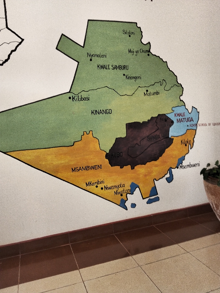
The image presents a multi-colored map of Kwale County, Kenya, painted or affixed onto a light-colored, textured wall. The map illustrates sub-county divisions and prominent locations. Visible regions include Kwale Samburu (green), Kinango (green), Kwale Matuga (light blue), Kubo (dark brown, containing Shima Hills), and Msambweni (orange). Coastal areas are represented by irregular blue shapes. Specific locations marked with black dots and labels include Silaloni, Nyamalani, Kilibasi, Kitole, Mkambini, Mwanyota, and Mwatoni. "KENYA SCHOOL OF GOVERN" text is partially visible near Kwale Matuga. The map covers the geographical area of Kwale County, encompassing the region where Waa Ngombeni ward is located, though Waa Ngombeni ward itself is not explicitly labeled. Below the map, a dark brown skirting board transitions to a brown tiled floor with visible grout lines. A terracotta-colored pot holding a green plant is partially visible on the lower right, positioned on the floor. No individuals, actions, or interactions are depicted.
Loading AttnAds…
No transactions found