Stake attention in this memory
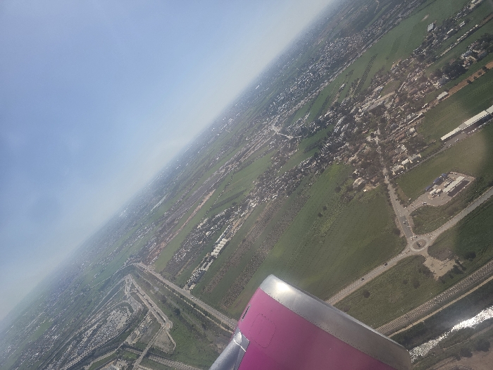
This aerial image provides a high-angle, oblique view of a cultivated and developed landscape, likely located within or immediately adjacent to the Sdot Dan Regional Council, Israel, specifically depicting areas near Ben Gurion International Airport (TLV). A portion of a magenta-colored aircraft engine nacelle with a metallic leading edge is visible in the lower-left corner, indicating the photograph was taken from an airborne airplane. The scene is dominated by extensive green agricultural fields, segmented by roads and irrigation channels. A major multi-lane highway traverses the mid-ground, flanked by built-up areas. In the lower-middle, a large roundabout serves as a junction for several connecting roads, near which a commercial or service complex with multiple buildings is situated. A narrow, reflective body of water runs parallel to a road in the far lower-left. Scattered residential or small community settlements, characterized by clusters of buildings and trees, are visible throughout the cultivated land. In the upper-left quadrant, a significant portion of an airport's infrastructure is discernible, featuring multiple runways or taxiways, extensive paved areas, and large industrial-type buildings, consistent with Ben Gurion International Airport. The sky in the upper-right is clear and light blue, with a slight atmospheric haze along the distant horizon. No individual persons or specific actions are discernible from this altitude.
Symbol
7D68B
Volume
1,354
Creator
+$0.00
Revenue
+$0.00
TVL
$0.32