
Sign in
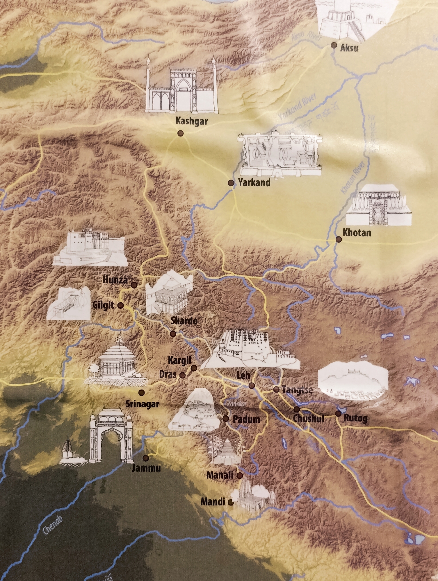
The image is a map of a mountainous region, likely in Central Asia or the Himalayas. It displays cities and points of interest marked with names and illustrative drawings of historical buildings or landmarks. Rivers are depicted in blue, and roads or trade routes are shown in yellow. The terrain is characterized by brown, rugged mountains.

Specifically, the city of Leh, India, is labeled on the map. It is situated in a valley and appears to be a junction for several yellow routes. Beside the label "Leh," there is a drawing of a fortress-like structure perched on a hill.
MaxOn

Aug 11, 2026, 7:49 AM

Leh, India

Stake attention in this memory

historical
cultural
adventurous
exploratory
educational

The image is a map of a mountainous region, likely in Central Asia or the Himalayas. It displays cities and points of interest marked with names and illustrative drawings of historical buildings or landmarks. Rivers are depicted in blue, and roads or trade routes are shown in yellow. The terrain is characterized by brown, rugged mountains. Specifically, the city of Leh, India, is labeled on the map. It is situated in a valley and appears to be a junction for several yellow routes. Beside the label "Leh," there is a drawing of a fortress-like structure perched on a hill.

Loading AttnAds…

transactions
revenues
stakers
Earliest
Latest
Highest stake

No transactions found
More from this user

More from Leh

MaxOn

Aug 11, 2026, 7:49 AM

Leh, India

Licensed under Creative Commons Attribution 4.0 International License. You are free to share and adapt this content with proper attribution.