Stake attention in this memory
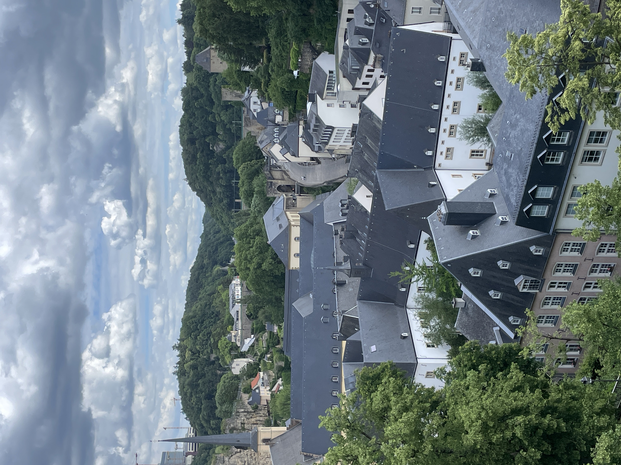
This is a high-angle, panoramic photograph depicting a portion of Luxembourg City, Luxembourg, specifically overlooking the Grund district within the Alzette Valley, with the Rham Plateau in the background. The vantage point suggests a location within the Upper City, possibly along the Chemin de la Corniche. The sky occupies the top quarter of the frame and features a dense covering of grey and white cumulus clouds, indicating an overcast day with diffused lighting. In the background, a verdant landscape of densely forested hills rises, framing the urban area. On the right side of the background, an ancient stone tower with a dark, conical roof is visible, partially obscured by trees. To its left, another section of historical stone fortification walls and a smaller tower are discernible amidst the foliage. A winding asphalt road, lined with buildings, traverses the valley floor in the midground, with a stone arched bridge visible where it passes under an elevated section of the city. The midground is dominated by an array of buildings with light-colored facades (white, beige, and soft pink) and steep, dark slate or tile roofs, many featuring multiple dormer windows. A large complex of interconnected buildings with extensive, dark, slightly sloped roofs, likely the Neumünster Abbey, is prominent in the middle-left. The spire of St. Michael's Church, characterized by its beige base and slender, dark-tiled steeple, rises on the far left, partially visible above other structures. The foreground is composed of the upper sections and dark roofs of several buildings, interspersed with the vibrant green canopy of deciduous trees. No individuals are visible, and no specific actions or interactions are depicted within the frame.
No transactions found