Stake attention in this memory
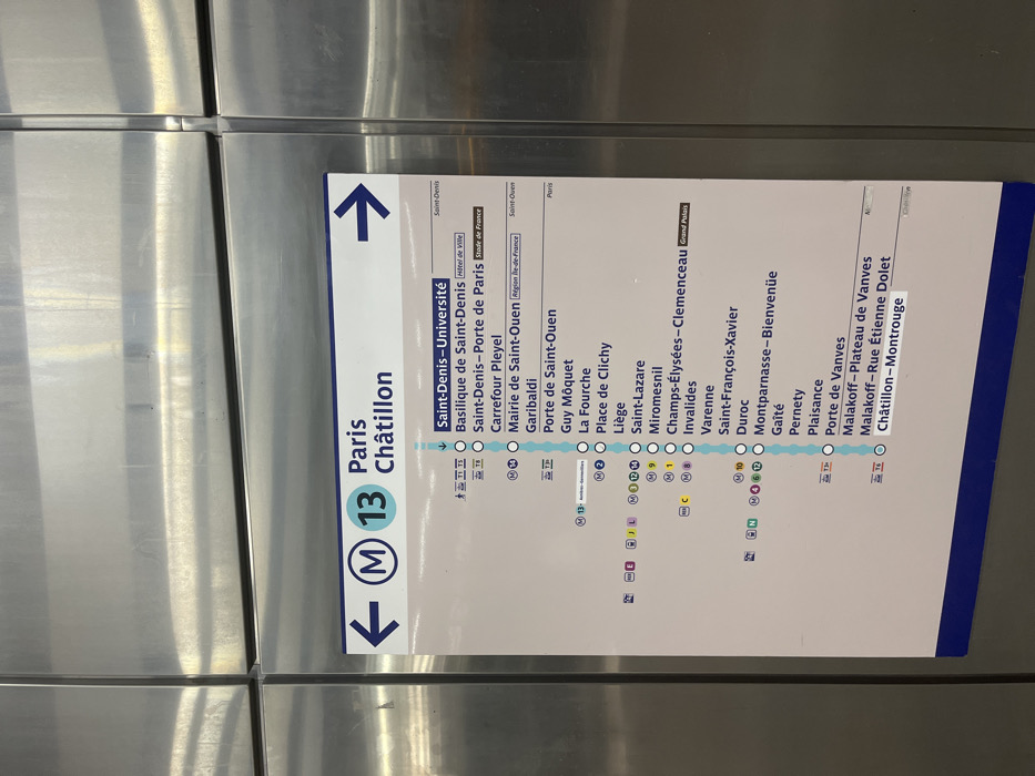
The image displays a metro line map, likely affixed to a metallic surface within a train car or station in Saint-Denis, France. The primary subject is a diagram for Paris Metro Line 13, indicated by a large "M 13" logo with arrows pointing left and up, suggesting direction. No people or dynamic activity are visible; the scene is static. The map details the stations along Line 13, running from its northern termini towards its southern terminus. The northern branch is highlighted, showing "Saint-Denis-Université" as one of the endpoints, alongside "Saint-Denis" and "Saint-Ouen" sections. Other visible stations include "Basilique de Saint-Denis" (near Hôtel de Ville), "Saint-Denis-Porte de Paris" (near Stade de France), "Carrefour Pleyel," and "Mairie de Saint-Ouen." The line continues through "Garibaldi," "Porte de Saint-Ouen," "Guy Môquet," "La Fourche," "Place de Clichy," "Liège," "Saint-Lazare," "Miromesnil," "Champs-Élysées-Clemenceau" (near Grand Palais), "Invalides," "Varenne," "Saint-François-Xavier," "Duroc," "Montparnasse-Bienvenüe," "Gaîté," "Pernety," "Plaisance," "Porte de Vanves," "Malakoff-Plateau de Vanves," "Malakoff-Rue Étienne Dolet," and finally "Châtillon-Montrouge" at the southern end. Several stations show connection points to other metro lines (M1, M2, M3, M4, M6, M9, M10, M12, M14) and tram lines (T1, T3a, T8), indicated by their respective numerical and alphabetical symbols. The metallic background reflects light, creating horizontal bands of varying brightness. The map itself is white with blue and light blue elements for the line and station markers. The overall impression is a functional, informative sign for public transport navigation.
Loading AttnAds…
No transactions found