
Stake attention in this memory
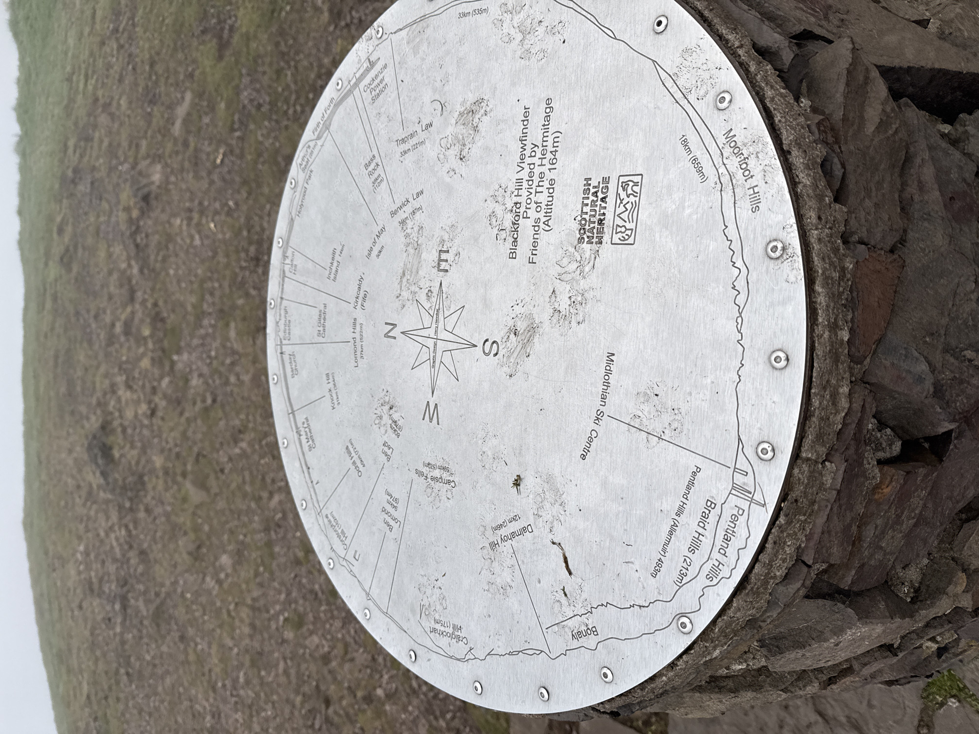
A circular, silver-colored metal viewpoint indicator, also known as a viewfinder, is prominently featured, secured to a rough, dark stone base with multiple rivets. The disc is engraved with a compass rose at its center, clearly marking North, East, South, and West. Radial lines extend from the compass, pointing towards various geographical landmarks. The viewfinder is titled "Blackford Hill Viewfinder Provided by Friends of The Hermitage (Altitude 164m)," indicating its specific location and purpose. It also displays the "SCOTTISH NATURAL HERITAGE" logo. The surface of the disc shows signs of use and weather exposure, with dirt and smudges visible. Numerous Scottish landmarks are identified, each with its distance from Blackford Hill and, in most cases, its altitude. These include: - To the east: Traprain Law (33km, 221m), Berwick Law (34km, 187m), Bass Rock (38km, 112m), Isle of May (50km), Cockenzie Power Station, Firth of Forth. - To the north: Arthur's Seat (251m), Holyrood Park, Edinburgh Castle, St Giles Cathedral, Calton Hill, Inchkeith Island (14km), Kirkcaldy (Fife), Lomond Hills (37km, 522m). - To the west: Knock Hill (31km, 364m), Campsie Fells (59km, 570m), Ben Lomond (94km, 974m), Ben Ledi (80km, 879m), Ochil Hills (46km, 721m), Corstorphine Hill (162m), Craiglockhart Hill (175m), Dalmahoy Hill (12km, 246m). - To the south: Bonaly, Midlothian Ski Centre, Pentland Hills (Allermuir 493m), Braid Hills (213m), and Moorfoot Hills (18km, 659m). The background reveals a hazy, possibly misty or overcast outdoor environment, consistent with a hilltop vantage point, showing indistinct green and brown terrain stretching into the distance. The image captures a functional outdoor informational display on a cloudy day.
Symbol
83427
Volume
2,973
Creator
+$0.00
Revenue
+$0.00
TVL
$0.21
Loading AttnAds…