Stake attention in this memory
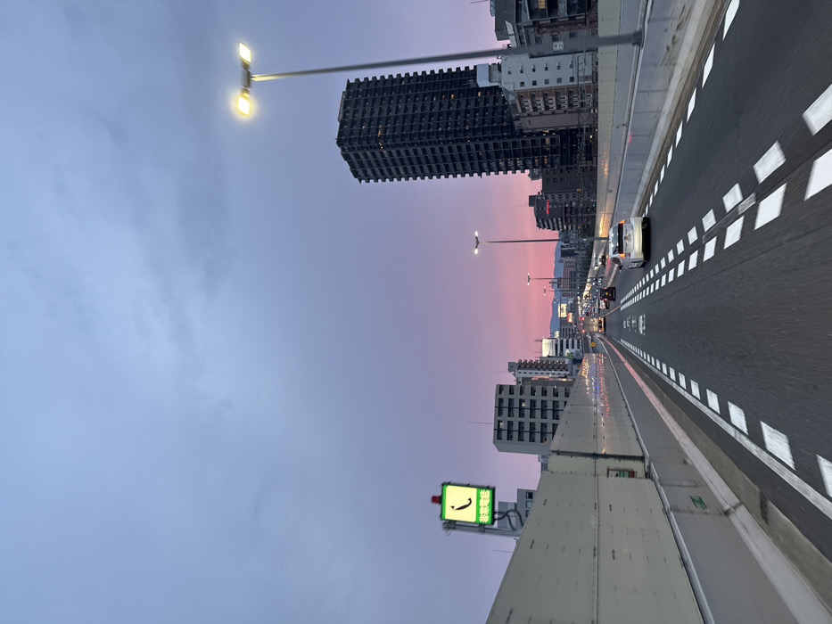
The image shows a view of an elevated highway in Osaka, Japan, taken from a car traveling on the highway towards the city center. The coordinates (latitude: 34.699, longitude: 135.486) place the location near the junction of the Hanshin Expressway and the Ikeda Line. The sky is a pale lavender, with a faint pink hue near the horizon, indicating a sunset. There are several buildings visible on the right side of the image, including a tall, dark building with many windows. The highway is wide and empty, with white lane markings. The image captures a few cars traveling in the same direction as the photographer, with one white car in the foreground. There is a large concrete barrier on the left, and several streetlights are visible, with one in the upper right corner of the image illuminating the scene. A green traffic sign with Japanese characters is visible on the left side of the image.
No transactions found