
Sign in
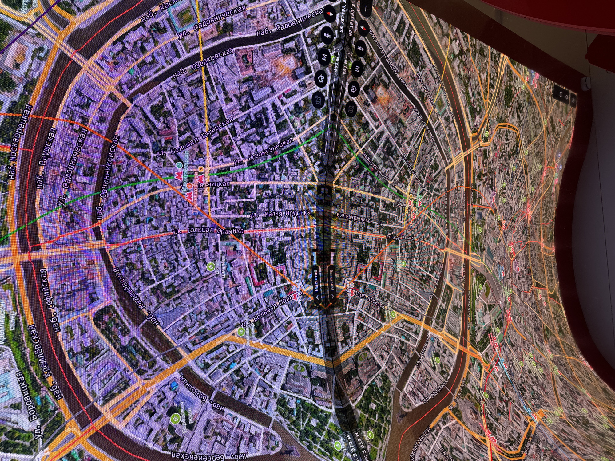
A large, curved digital display presents a detailed, interactive map of central Moscow, Russia, viewed from an elevated perspective. The map features a satellite imagery base with overlaid street names, route lines (red, orange, green, purple), and points of interest. The Moscow River is prominent, curving through the city, flanked by numerous embankments such as "наб. Кремлёвская" (Kremlin Embankment), "наб. Москворецкая" (Moskvoretskaya Embankment), and "наб. Садовническая" (Sadovnicheskaya Embankment).

Key streets like "ул. Большая Ордынка" (Bolshaya Ordynka Street), "ул. Малая Ордынка" (Malaya Ordynka Street), and "ул. Новокузнецкая" (Novokuznetskaya Street) are clearly labeled. Green areas, representing parks or squares like "Кремлевский сквер" (Kremlin Square) and "Парк" (Park), are interspersed among dense urban blocks. Red 'M' symbols indicate metro stations.

A central vertical strip on the display shows interactive controls, including "Масштаб" (Scale) and distance measurements of "2 973 M" (2973 meters) and "491 M". Geographic coordinates "55.757193, 37.62183" are also visible, confirming the Moscow location. No people or specific activity are captured in the image, suggesting the focus is on the display itself. The curved nature of the screen distorts the perspective, especially towards the right side of the image. The overall setting appears to be indoors, likely an exhibition or information center.
PavelPV

Jun 4, 2026, 1:51 PM

Shushary, Russia

Stake attention in this memory

curiosity
wonder
awe
fascination
discovery

A large, curved digital display presents a detailed, interactive map of central Moscow, Russia, viewed from an elevated perspective. The map features a satellite imagery base with overlaid street names, route lines (red, orange, green, purple), and points of interest. The Moscow River is prominent, curving through the city, flanked by numerous embankments such as "наб. Кремлёвская" (Kremlin Embankment), "наб. Москворецкая" (Moskvoretskaya Embankment), and "наб. Садовническая" (Sadovnicheskaya Embankment). Key streets like "ул. Большая Ордынка" (Bolshaya Ordynka Street), "ул. Малая Ордынка" (Malaya Ordynka Street), and "ул. Новокузнецкая" (Novokuznetskaya Street) are clearly labeled. Green areas, representing parks or squares like "Кремлевский сквер" (Kremlin Square) and "Парк" (Park), are interspersed among dense urban blocks. Red 'M' symbols indicate metro stations. A central vertical strip on the display shows interactive controls, including "Масштаб" (Scale) and distance measurements of "2 973 M" (2973 meters) and "491 M". Geographic coordinates "55.757193, 37.62183" are also visible, confirming the Moscow location. No people or specific activity are captured in the image, suggesting the focus is on the display itself. The curved nature of the screen distorts the perspective, especially towards the right side of the image. The overall setting appears to be indoors, likely an exhibition or information center.

Loading AttnAds…

transactions
revenues
stakers
Earliest
Latest
Highest stake

No transactions found

More from this user

More from Shushary

PavelPV

Jun 4, 2026, 1:51 PM

Shushary, Russia

Licensed under Creative Commons Attribution 4.0 International License. You are free to share and adapt this content with proper attribution.