Stake attention in this memory
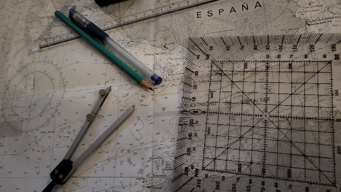
An overhead view captures navigation tools arrayed on a nautical chart, set within the city of Calvià, Spain. The prominent subject is a light-toned marine chart displaying bathymetric data, coastal features, and text identifying the "ESTRECHO" (Strait), "GIBRALTAR," and "ESPAÑA," specifically indicating the region around Punta de Tarifa. Essential objects include a silver and black drafting compass, open, positioned in the upper-left. A green wooden pencil and a transparent blue ballpoint pen lie diagonally near the center. Overlapping the lower half of the chart is a clear, square plotter ruler marked with a compass rose, a detailed numerical scale (e.g., 300-350, 0-50, 60-130), and a grid, through which map details are discernible. The arrangement suggests an active navigation planning or study scenario.
No transactions found