Sign in
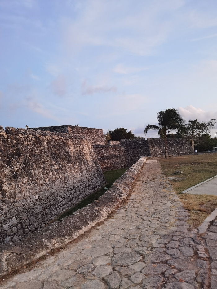
The image shows a stone pathway leading into a fortified structure. The path is cobblestone and curves to the right. To the left is a stone wall, approximately 10 feet high, that runs perpendicular to the path. The wall is made of rough-hewn stones and appears to be ancient. The path is bordered by a grassy area that is largely brown, indicating dry conditions. There are no people visible in the image. The coordinates (latitude: 18.677, longitude: -88.389) locate the scene in Bacalar, Mexico, at a site within the fortified walls of the town, likely the historic San Felipe Fort. The sky is a pale blue with wispy clouds and the sun appears to be setting.
F
FM-JgPQm1

Apr 2, 2025, 12:20 AM

Bacalar, Mexico

Stake attention in this memory

historical
ancient
rugged
serene
calm

The image shows a stone pathway leading into a fortified structure. The path is cobblestone and curves to the right. To the left is a stone wall, approximately 10 feet high, that runs perpendicular to the path. The wall is made of rough-hewn stones and appears to be ancient. The path is bordered by a grassy area that is largely brown, indicating dry conditions. There are no people visible in the image. The coordinates (latitude: 18.677, longitude: -88.389) locate the scene in Bacalar, Mexico, at a site within the fortified walls of the town, likely the historic San Felipe Fort. The sky is a pale blue with wispy clouds and the sun appears to be setting.

Loading AttnAds…

transactions
revenues
stakers
Earliest
Latest
Highest stake

No transactions found
More from this user

More from Bacalar

FFM-JgPQm1

Apr 2, 2025, 12:20 AM

Bacalar, Mexico

Licensed under Creative Commons Attribution 4.0 International License. You are free to share and adapt this content with proper attribution.