Stake attention in this memory
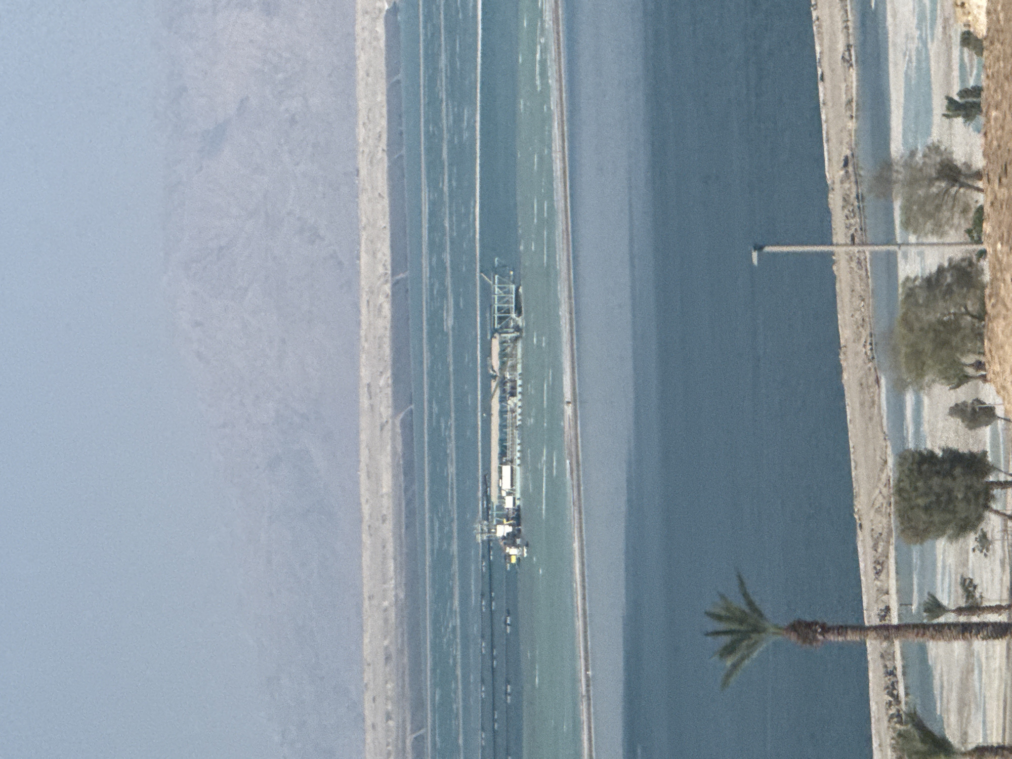
The image depicts an aerial view of a salt evaporation pond system, likely used for extracting minerals from hypersaline water. The scene is divided into distinct sections: to the left, a hazy, mountainous landscape fades into a pale blue sky. Adjacent to this is a strip of light-colored land, possibly a beach or embankment. The central and dominant portion of the image features a series of rectangular, shallow ponds, separated by raised causeways. These ponds are filled with water that varies in color from a light, greenish-blue to a deeper teal, indicating different stages of salt concentration. A long, elevated structure, resembling an industrial processing plant or pier, stretches across one of the ponds, with various buildings and equipment visible on it. Small boats or floating platforms are scattered within the ponds. To the right of the ponds, a sandy shoreline is visible, bordered by a line of sparse vegetation, including palm trees. A single lamppost stands on this shoreline, suggesting it is an accessible area. The overall atmosphere is serene, with no visible people. The lighting suggests it is daytime, possibly late morning or early afternoon, with clear weather. The location is identified as the Tamar Regional Council in Israel, which is known for its proximity to the Dead Sea, a significant source of mineral extraction. There is no visible text in the image.
No transactions found