Sign in
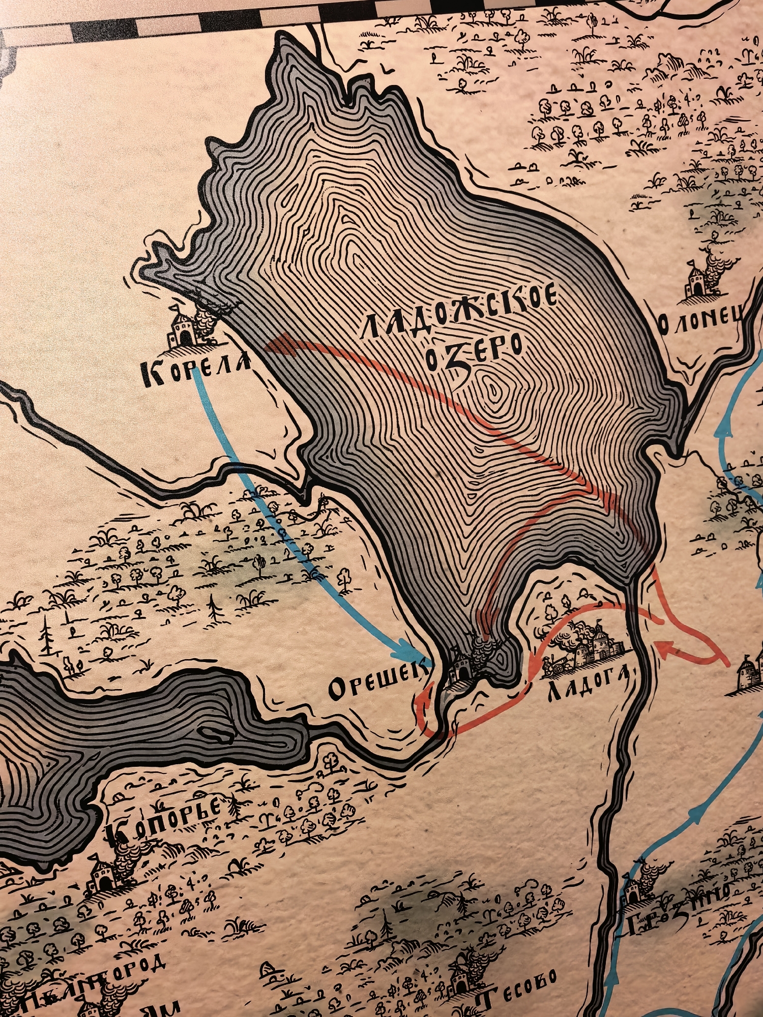
The image is a section of an old, stylized map of Staraya Ladoga, Russia. The map depicts a large body of water, labeled "ЛАДОЖСКОЕ ОЗЕРО" (Ladoga Lake), with contour lines indicating elevation. Several settlements are marked with fortified structures, such as "КОРЕЛА" (Korela), "ОРЕШЕК" (Oreshek), "ЛАДОГА" (Ladoga), and a partially visible "ППГОРOД" (Ppgorod) and "ЕСОБО" (Esobo). Red and blue arrows are drawn on the map, suggesting routes or movements, possibly military. The map features small drawings of trees, grass, and other vegetation. The overall aesthetic is that of an antique illustration with a limited color palette of black, grey, and beige, with red and blue accents for the arrows.
FM-OXF9M2

Aug 2, 2026, 12:38 PM

Staraya Ladoga, Russia

Stake attention in this memory

Nostalgic
Adventurous
Mysterious
Historical
Intriguing

The image is a section of an old, stylized map of Staraya Ladoga, Russia. The map depicts a large body of water, labeled "ЛАДОЖСКОЕ ОЗЕРО" (Ladoga Lake), with contour lines indicating elevation. Several settlements are marked with fortified structures, such as "КОРЕЛА" (Korela), "ОРЕШЕК" (Oreshek), "ЛАДОГА" (Ladoga), and a partially visible "ППГОРOД" (Ppgorod) and "ЕСОБО" (Esobo). Red and blue arrows are drawn on the map, suggesting routes or movements, possibly military. The map features small drawings of trees, grass, and other vegetation. The overall aesthetic is that of an antique illustration with a limited color palette of black, grey, and beige, with red and blue accents for the arrows.

Loading AttnAds…

transactions
revenues
stakers
Earliest
Latest
Highest stake

No transactions found

More from this user

More from Staraya Ladoga

FM-OXF9M2

Aug 2, 2026, 12:38 PM

Staraya Ladoga, Russia

Licensed under Creative Commons Attribution 4.0 International License. You are free to share and adapt this content with proper attribution.